Old Cumbria Gazetteer
 |
 |
|
||
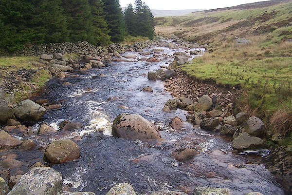
| Wasdale Beck | ||||
| runs into:- |  Birk Beck Birk Beck |
|||
|
|
||||
| locality:- | Wasdale | |||
| civil parish:- | Shap Rural (formerly Westmorland) | |||
| civil parish:- | Orton S (formerly Westmorland) | |||
| county:- | Cumbria | |||
| locality type:- | river | |||
| locality type:- | boundary | |||
| locality type:- | parish boundary | |||
| 1Km square:- | NY5608 (etc) | |||
| 10Km square:- | NY50 | |||
|
|
||||
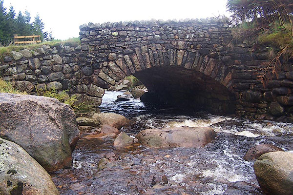
 BMT15.jpg At Wasdale Old Bridge. (taken 6.10.2006) 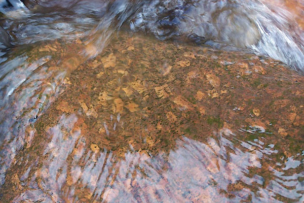 BMT16.jpg Shap granite in the stream bed at Wasdale Old Bridge. Note, these have been washed downstream from their original bed. (taken 6.10.2006) |
||||
|
|
||||
| evidence:- | old map:- OS County Series (Wmd 21 14) placename:- Wasdale Beck |
|||
| source data:- | Maps, County Series maps of Great Britain, scales 6 and 25
inches to 1 mile, published by the Ordnance Survey, Southampton,
Hampshire, from about 1863 to 1948. |
|||
|
|
||||
| evidence:- | old map:- Saxton 1579 placename:- Burhek Flu. |
|||
| source data:- | Map, hand coloured engraving, Westmorlandiae et Cumberlandiae Comitatus ie Westmorland
and Cumberland, scale about 5 miles to 1 inch, by Christopher Saxton, London, engraved
by Augustinus Ryther, 1576, published 1579-1645.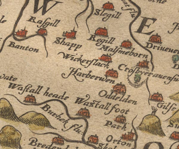 Sax9NY51.jpg "Burhek flu:" item:- private collection : 2 Image © see bottom of page |
|||
|
|
||||
| evidence:- | old map:- Jansson 1646 placename:- Burbeck Flud |
|||
| source data:- | Map, hand coloured engraving, Cumbria and Westmoria, ie
Cumberland and Westmorland, scale about 3.5 miles to 1 inch, by
John Jansson, Amsterdam, Netherlands, 1646.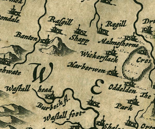 JAN3NY51.jpg "Burbeck fl." Buildings and tower. item:- JandMN : 88 Image © see bottom of page |
|||
|
|
||||
| evidence:- | old map:- Ogilby 1675 (plate 38) |
|||
| source data:- | Road strip map, hand coloured engraving, continuation of the
Road from London to Carlisle, scale about 1 inch to 1 mile, by
John Ogilby, London, 1675.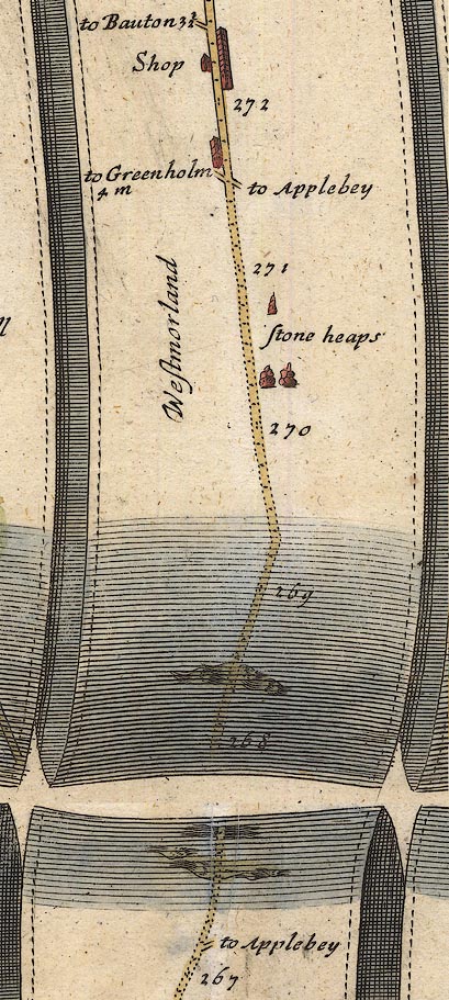 OG38m267.jpg In mile 267, Westmorland. Road crosses a river, no bridge drawn. item:- JandMN : 21 Image © see bottom of page |
|||
|
|
||||
| evidence:- | old map:- Bowen and Kitchin 1760 |
|||
| source data:- | Map, hand coloured engraving, A New Map of the Counties of
Cumberland and Westmoreland Divided into their Respective Wards,
scale about 4 miles to 1 inch, by Emanuel Bowen and Thomas
Kitchin et al, published by T Bowles, Robert Sayer, and John
Bowles, London, 1760.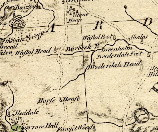 BO18NY40.jpg wiggly line, becomes Birk Beck item:- Armitt Library : 2008.14.10 Image © see bottom of page |
|||
|
|
||||
| evidence:- | old map:- Jefferys 1770 (Wmd) |
|||
| source data:- | Map, 4 sheets, The County of Westmoreland, scale 1 inch to 1
mile, surveyed 1768, and engraved and published by Thomas
Jefferys, London, 1770.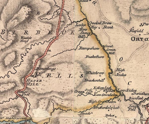 J5NY50NE.jpg single or double wiggly line; river item:- National Library of Scotland : EME.s.47 Image © National Library of Scotland |
|||
|
|
||||
| evidence:- | old map:- Cary 1789 (edn 1805) |
|||
| source data:- | Map, uncoloured engraving, Westmoreland, scale about 2.5 miles
to 1 inch, by John Cary, London, 1789; edition 1805.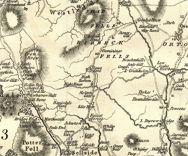 CY24NY50.jpg river running into Birk Beck item:- JandMN : 129 Image © see bottom of page |
|||
|
|
||||
| evidence:- | probably descriptive text:- Otley 1823 (5th edn 1834) |
|||
| source data:- | Guide book, A Concise Description of the English Lakes, the
mountains in their vicinity, and the roads by which they may be
visited, with remarks on the mineralogy and geology of the
district, by Jonathan Otley, published by the author, Keswick,
Cumberland now Cumbria, by J Richardson, London, and by Arthur
Foster, Kirkby Lonsdale, Cumbria, 1823; published 1823-49,
latterly as the Descriptive Guide to the English Lakes. goto source Page 40:- "Two small streams, crossing the road between Kendal and Shap, fall into the Lune ..." |
|||
|
|
||||
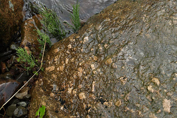 BPQ26.jpg Shap granite in the stream bed at Wasdale Old Bridge, Note, these have been washed downstream from their original bed. (taken 24.8.2008) 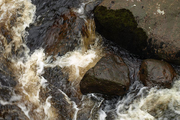 BPQ27.jpg Rocks and water at Wasdale Old Bridge. (taken 24.8.2008) |
||||
|
|
||||
| notes:- |
The Shap granite here is not in situ, but has come from the intrusion further up the
valley, where Shap Pink Quarry is situated. |
|||
| The granite is a porphyry, with two different sizes of crystals. The smaller crsytals
are black - biotite, grey - quartz, and white - plagioclase. The larger crystals are
twinned orthoclase feldspar. |
||||
| NB: beware my amateur geological knowledge. |
||||
|
|
||||
| places:- |
|
|||
|
||||
Lakes Guides menu.