 Old Cumbria Gazetteer
 |
 |
|
| included in:- |
 Derwent Water Derwent Water |
|
| viewpoint, Castle Crag | ||
| site name:- | Castle Crag | |
| civil parish:- | Borrowdale (formerly Cumberland) | |
| county:- | Cumbria | |
| locality type:- | viewpoint | |
| coordinates:- | NY24961596 (about) | |
| 1Km square:- | NY2415 | |
| 10Km square:- | NY21 | |
|
|
||
| evidence:- | descriptive text:- West 1778 (11th edn 1821) placename:- station, Derwent Water, West 4 |
|
| source data:- | Guide book, A Guide to the Lakes, by Thomas West, published by
William Pennington, Kendal, Cumbria once Westmorland, and in
London, 1778 to 1821. goto source Page 94:- "STATION IV. From the top of Castle-crag in Borrowdale, there is a most astonishing view of the lake and vale of Keswick, spread out to the north in the most picturesque manner. Every bend of the river is distinctly" goto sourcePage 95:- "seen, from the pass of Borrowdale, till it joins the lake; the lake itself spotted with islands; the most extraordinary line of shore, varied with all the surprising accompaniments of rock and wood; the village of Grange at the foot of the crag, and the white houses of Keswick with Crosthwaite church at the lower end of the lake; behind these, much cultivation, with a beautiful mixture of villages, houses, cots, and farms, standing round the skirts of Skiddaw, which rises in the grandest manner, from a verdant base, and closes this prospect in the noblest style of nature's true sublime. From the summit of this rock, the views are so singularly great and pleasing, that they ought never to be omitted. The ascent is by one of the narrow paths, cut in the side of the mountain, for carrying down the slate that is quarried on its top." "The view to the north, or the vale of Keswick, is already described; that to the south lies in Borrowdale. The river is seen winding upward from the lake, through the rugged pass, to where it divides, and embraces a triangular vale, completely cut into inclosures of meadow, enamelled with the softest verdure, and fields waving with fruitful crops. This truly secreted spot, is completely surrounded by the most horrid, romantic moun-" goto sourcePage 96:- "[moun]tains that are in this region of wonders; and whoever omits this coup d'oeil, hath probably seen nothing equal to it." "The views here, taken in the glass, when the sun shines, are amazingly fine." "This picture is reversed from the summit of Latrig." |
|
|
|
||
| evidence:- | old map:- Crosthwaite 1783-94 (Der) placename:- station, Derwent Water, West 4 |
|
| source data:- | Map, uncoloured engraving, An Accurate Map of the Matchless Lake
of Derwent, ie Derwent Water, scale about 3 inches to 1 mile, by
Peter Crosthwaite, Keswick, Cumberland, 1783, version published
1800.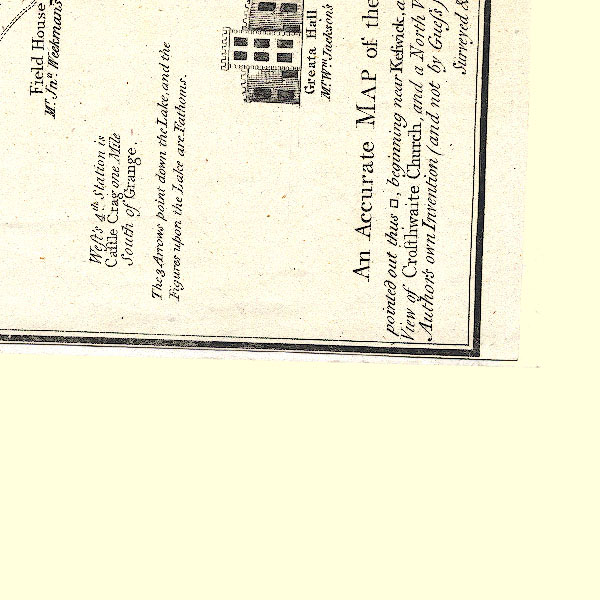 CT2NY21S.jpg "West's 4th. Station is Castle Crag one Mile South of Grange" which is off the map sheet. item:- Armitt Library : 1959.191.3 Image © see bottom of page |
|
|
|
||
| indexing | ||
| person:- | author : West, Thomas |
|
| place:- | Derwent Water | |
| date:- | 1778 |
|
| period:- | 18th century, late | |
| period:- | 1780s | |
| item:- | guide book; Guide to the Lakes |
|
|
|
||
Lakes Guides menu.