Old Cumbria Gazetteer
 |
 |
|
||
| Scandale Beck | ||||
| runs into:- |  Rothay, River Rothay, River |
|||
|
|
||||
| site name:- | Scandale | |||
| civil parish:- | Lakes (formerly Westmorland) | |||
| county:- | Cumbria | |||
| locality type:- | river | |||
| 1Km square:- | NY3707 | |||
| 10Km square:- | NY30 | |||
|
|
||||
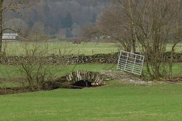
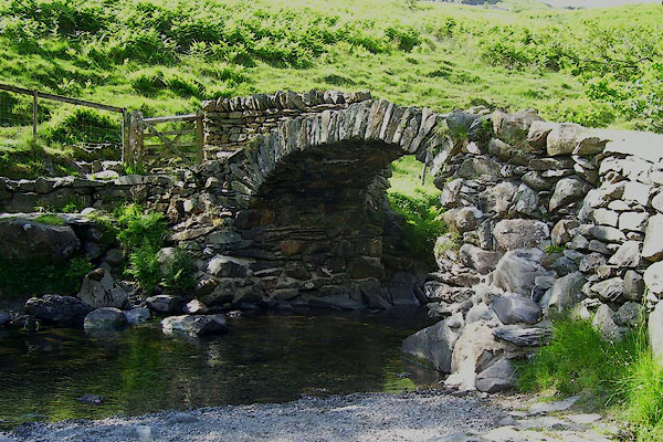
 BPH74.jpg At High Sweden Bridge. (taken 9.6.2008) 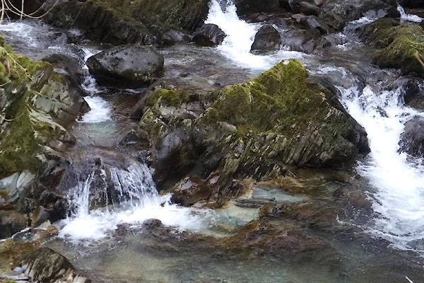 CCJ99.jpg At Low Sweden Bridge. (taken 11.2.2015) |
||||
|
|
||||
| evidence:- | old map:- OS County Series (Wmd 26 2) placename:- Scandale Beck |
|||
| source data:- | Maps, County Series maps of Great Britain, scales 6 and 25
inches to 1 mile, published by the Ordnance Survey, Southampton,
Hampshire, from about 1863 to 1948. |
|||
|
|
||||
| evidence:- | old map:- OS County Series (Wmd 19 14) placename:- Scandale Beck |
|||
| source data:- | Maps, County Series maps of Great Britain, scales 6 and 25
inches to 1 mile, published by the Ordnance Survey, Southampton,
Hampshire, from about 1863 to 1948. OS County Series (Wmd 26 6) |
|||
|
|
||||
| evidence:- | old map:- Saxton 1579 |
|||
| source data:- | Map, hand coloured engraving, Westmorlandiae et Cumberlandiae Comitatus ie Westmorland
and Cumberland, scale about 5 miles to 1 inch, by Christopher Saxton, London, engraved
by Augustinus Ryther, 1576, published 1579-1645.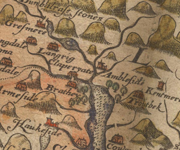 Sax9NY30.jpg item:- private collection : 2 Image © see bottom of page |
|||
|
|
||||
| evidence:- | old map:- Speed 1611 (Wmd) |
|||
| source data:- | Map, hand coloured engraving, The Countie Westmorland and
Kendale the Cheif Towne, scale about 2.5 miles to 1 inch, by
John Speed, 1610, published by George Humble, Popes Head Alley,
London, 1611-12.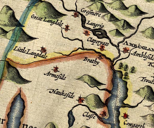 SP14NY30.jpg double line, into the Rothay item:- Armitt Library : 2008.14.5 Image © see bottom of page |
|||
|
|
||||
| evidence:- | old map:- Ogilby 1675 (plate 96) |
|||
| source data:- | Road strip map, hand coloured engraving, the Road from Kendal to
Cockermouth, and the Road from Egremond to Carlisle, scale about
1 inch to 1 mile, by John Ogilby, London, 1675.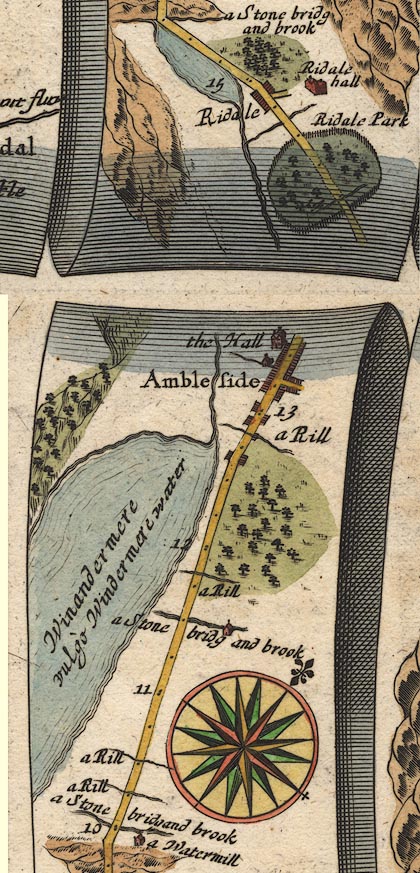 OG96m010.jpg In mile 14, Westmerland. River drawn across the road, in Rydal Park. item:- JandMN : 22 Image © see bottom of page |
|||
|
|
||||
| evidence:- | old map:- Seller 1694 (Wmd) |
|||
| source data:- | Map, hand coloured engraving, Westmorland, scale about 8 miles
to 1 inch, by John Seller, 1694. click to enlarge click to enlargeSEL7.jpg tapering wiggly line; river item:- Dove Cottage : 2007.38.87 Image © see bottom of page |
|||
|
|
||||
| evidence:- | old map:- Bowen and Kitchin 1760 placename:- Ruthy River |
|||
| source data:- | Map, hand coloured engraving, A New Map of the Counties of
Cumberland and Westmoreland Divided into their Respective Wards,
scale about 4 miles to 1 inch, by Emanuel Bowen and Thomas
Kitchin et al, published by T Bowles, Robert Sayer, and John
Bowles, London, 1760.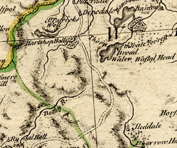 BO18NY30.jpg "Ruthy R." wiggly line 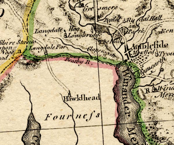 BO18SD29.jpg wiggly line, into the Rothay item:- Armitt Library : 2008.14.10 Image © see bottom of page |
|||
|
|
||||
| evidence:- | old map:- Jefferys 1770 (Wmd) |
|||
| source data:- | Map, 4 sheets, The County of Westmoreland, scale 1 inch to 1
mile, surveyed 1768, and engraved and published by Thomas
Jefferys, London, 1770.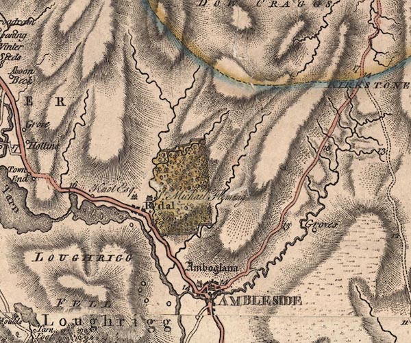 J5NY30NE.jpg single or double wiggly line; river item:- National Library of Scotland : EME.s.47 Image © National Library of Scotland |
|||
|
|
||||
| evidence:- | old map:- Clarke 1787 map (Ambleside to Keswick) |
|||
| source data:- | Map, A Map of the Roads Lakes etc between Keswick and Ambleside,
scale about 2.5 ins to 1 mile, by James Clarke, engraved by S J
Neele, 352 Strand, published by James Clarke, Penrith,
Cumberland and in London etc, 1787. CL9NY30S.jpg item:- private collection : 10.9 Image © see bottom of page |
|||
|
|
||||
| evidence:- | old print:- Green 1815 placename:- Scandale Beck item:- waterfall |
|||
| source data:- | Print, coloured aquatint, Scandale Beck, Westmorland, by William Green, Ambleside,
Westmorland, 1815.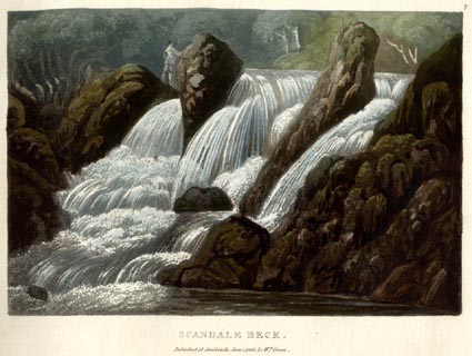 click to enlarge click to enlargeGN0506.jpg Plate 7 in Lake Scenery. printed at upper right:- "7" printed at bottom:- "SCANDALE BECK. / Published at Ambleside, June 1, 1815, by Wm. Green." item:- Armitt Library : A6646.6 Image © see bottom of page |
|||
|
|
||||
| evidence:- | descriptive text:- Ford 1839 (3rd edn 1843) placename:- Scandale Beck |
|||
| source data:- | Guide book, A Description of Scenery in the Lake District, by
Rev William Ford, published by Charles Thurnam, Carlisle, by W
Edwards, 12 Ave Maria Lane, Charles Tilt, Fleet Street, William
Smith, 113 Fleet Street, London, by Currie and Bowman,
Newcastle, by Bancks and Co, Manchester, by Oliver and Boyd,
Edinburgh, and by Sinclair, Dumfries, 1839. goto source Page 34:- "..." "Scandale Beck, on the road to Keswick, presents some pretty cascades, especially if the walk be extended up from Scandale Bridge. The Nook Bridge and the Gale are equally inviting." |
|||
|
|
||||
| evidence:- | old print:- Green 1815 (plate 7) placename:- Scandale Beck |
|||
| source data:- | Print, colour aquatint, Scandale Beck, Westmorland, by William Green, Ambleside, Westmorland,
1815.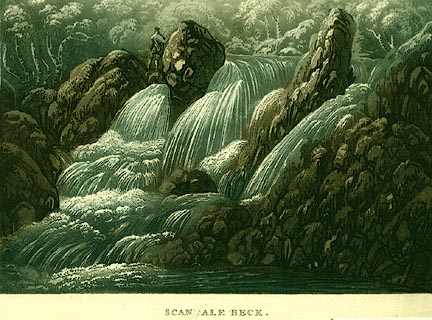 click to enlarge click to enlargePR0116.jpg Plate 7 in a set of prints, Lake Scenery. printed at bottom:- "SCANDALE BECK. / Published at Ambleside, June 1, 1815, by Wm. Green." item:- Dove Cottage : 2008.107.116 Image © see bottom of page |
|||
|
|
||||
| evidence:- | old painting:- Ibbetson 1780-1830 |
|||
| source data:- | Painting, watercolour, Nook End Bridge, ie Low Sweden Bridge at Nook End on Scandale
Beck, Ambleside, Westmorland, by Julius Caesar Ibbetson, late 18th early 19th century.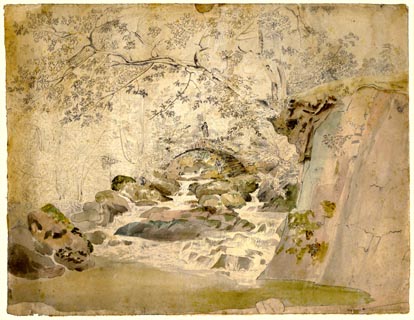 click to enlarge click to enlargePR1807.jpg ms, pencil, lower right "N[ End] Bridge [Ambleside]" item:- Armitt Library : 1959.82 Image © see bottom of page |
|||
|
|
||||
| places:- |
|
|||
|
||||
|
||||
|
||||
|
||||
Lakes Guides menu.