 Old Cumbria Gazetteer
 |
 |
|
| roman road 84, Cumbria | ||
| roman road 84 | ||
| Maiden Way | ||
| civil parish:- | Kirkby Thore (formerly Westmorland) | |
| county:- | Cumbria | |
| locality type:- | roman road | |
| locality type:- | road | |
| locality:- | Carvoran | |
| county:- | Northumberland | |
| locality type:- | roman road | |
| locality type:- | road | |
|
|
||
| evidence:- | old map:- Stukeley 1723 |
|
| source data:- | Road map, uncoloured engraving, the Antonine Itineraries through
Britain, scale about 55 miles to 1 inch, plotted by William
Stukeley, 1723, published London, 1724.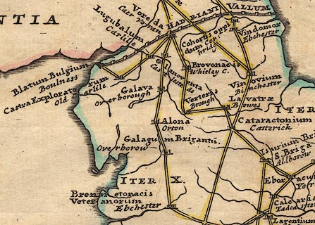 click to enlarge click to enlargeStu1Cm.jpg "ITER X." item:- Hampshire Museums : FA2001.171 Image © see bottom of page |
|
|
|
||
 Lakes Guides menu.