 Old Cumbria Gazetteer
 |
 |
|
| Ramp Holme, Windermere lake | ||
| Ramp Holme | ||
| Rogerholm | ||
| Berkshire Island | ||
| site name:- | Windermere lake | |
| civil parish:- | Windermere (formerly Westmorland) | |
| county:- | Cumbria | |
| locality type:- | island | |
| coordinates:- | SD39389525 | |
| 1Km square:- | SD3995 | |
| 10Km square:- | SD39 | |
|
|
||
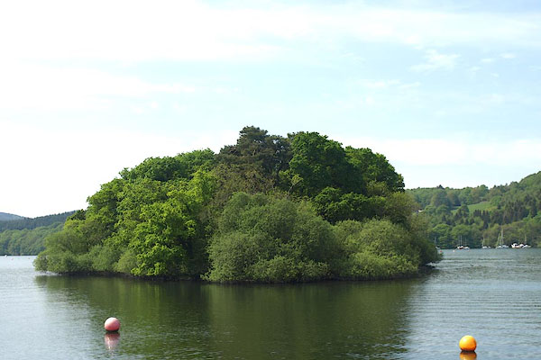 BPE46.jpg (taken 12.5.2008) |
||
|
|
||
| evidence:- | old map:- OS County Series (Wmd 32 15) placename:- Ramp Holme |
|
| source data:- | Maps, County Series maps of Great Britain, scales 6 and 25
inches to 1 mile, published by the Ordnance Survey, Southampton,
Hampshire, from about 1863 to 1948. |
|
| source data:- | Maps, County Series maps of Great Britain, scales 6 and 25
inches to 1 mile, published by the Ordnance Survey, Southampton,
Hampshire, from about 1863 to 1948. |
|
|
|
||
| evidence:- | descriptive text:- West 1778 (11th edn 1821) placename:- Rampsholme placename:- Berkshire Island |
|
| source data:- | Guide book, A Guide to the Lakes, by Thomas West, published by
William Pennington, Kendal, Cumbria once Westmorland, and in
London, 1778 to 1821. goto source goto sourcePage 57:- "[from station, Windermere 1] In front, Rampsholme, or Berkshire-island [2], presents itself in all its length, clothed in wood. ..." "[2] This little island has descended with the Levens estates time immemorial, and is now the property of the Hon. Fulk Greville Howard." |
|
|
|
||
| evidence:- | old map:- Crosthwaite 1783-94 (Win/Ble) placename:- Berkshire Island |
|
| source data:- | Map, uncoloured engraving, An Accurate Map of the Grand Lake of
Windermere, scale about 2 inches to 1 mile, by Peter
Crosthwaite, Keswick, Cumberland, 1783, version published 1819.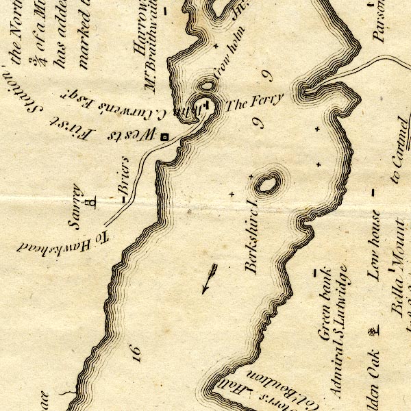 CT9SD39X.jpg "Berkshire I." island item:- Armitt Library : 2008.14.102 Image © see bottom of page |
|
|
|
||
| evidence:- | old map:- West 1784 map |
|
| source data:- | Map, hand coloured engraving, A Map of the Lakes in Cumberland,
Westmorland and Lancashire, scale about 3.5 miles to 1 inch,
engraved by Paas, 53 Holborn, London, about 1784.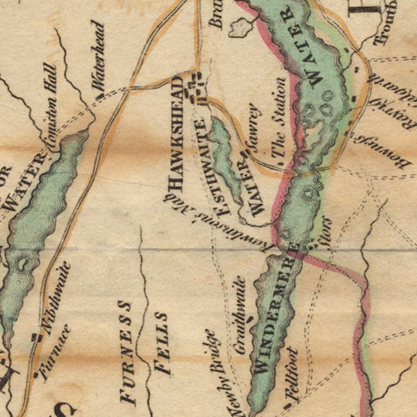 Ws02SD39.jpg In Windermere Water. item:- Armitt Library : A1221.1 Image © see bottom of page |
|
|
|
||
| evidence:- | old map:- Clarke 1787 map (Windermere S) placename:- Berkshire Island |
|
| source data:- | Map, A Map of the Southern Part of the Lake Winandermere and its
Environs, scale about 6.5 ins to 1 mile, by James Clarke,
engraved by Samuel John Neele, 352 Strand, published by James
Clarke, Penrith, Cumberland and in London etc, 1787.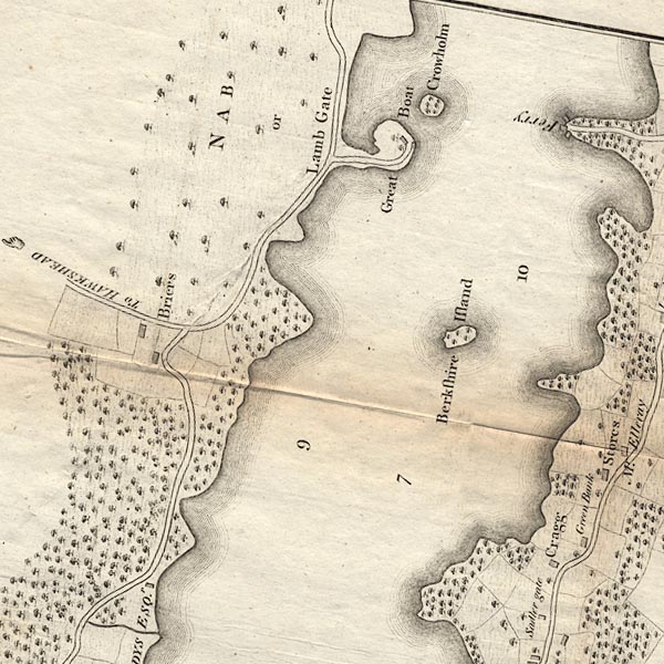 CLBSD39X.jpg "Berkshire Island" item:- private collection : 10.11 Image © see bottom of page |
|
|
|
||
| evidence:- | old text:- Camden 1789 (Gough Additions) placename:- Roger Holme |
|
| source data:- | Book, Britannia, or A Chorographical Description of the Flourishing Kingdoms of England,
Scotland, and Ireland, by William Camden, 1586, translated from the 1607 Latin edition
by Richard Gough, published London, 1789. goto source Page 155:- "[Roger] Holme, which is of Lumley fee; whereof William de Thweng died seised in 14 Edward III. It was granted by Henry VIII. with the rest of the Lumley fee to Allan Bellingham, esq., and now belongs (with the other Bellingham estates in Westmorland) to the present Earl of Suffolk and Berkshire." |
|
|
|
||
| evidence:- | old map:- Prior 1874 map 1 placename:- Hamp Holme |
|
| source data:- | Map, uncoloured engraving or lithograph? Winander Mere, scale
about 2.5 miles to 1 inch, published by John Garnett,
Windermere, Westmorland, 1874. click to enlarge click to enlargePI03M1.jpg "Hamp H." island item:- private collection : 133.1 Image © see bottom of page |
|
|
|
||
| hearsay:- |
The owner in the 18th century was the Earl of Berkshire. |
|
|
|
||
Lakes Guides menu.