 Old Cumbria Gazetteer
 |
 |
|
| Pull Wyke, Windermere lake | ||
| Pull Wyke | ||
| site name:- | Windermere lake | |
| civil parish:- | Windermere (formerly Westmorland) | |
| county:- | Cumbria | |
| locality type:- | bay | |
| coordinates:- | NY36490212 | |
| 1Km square:- | NY3602 | |
| 10Km square:- | NY30 | |
|
|
||
| evidence:- | old map:- OS County Series (Wmd 26 14) placename:- Pull Wyke |
|
| source data:- | Maps, County Series maps of Great Britain, scales 6 and 25
inches to 1 mile, published by the Ordnance Survey, Southampton,
Hampshire, from about 1863 to 1948. OS County Series (Lan 2 6) |
|
|
|
||
| evidence:- | old map:- Crosthwaite 1783-94 (Win/Ble) placename:- Pull Wike |
|
| source data:- | Map, uncoloured engraving, An Accurate Map of the Grand Lake of
Windermere, scale about 2 inches to 1 mile, by Peter
Crosthwaite, Keswick, Cumberland, 1783, version published 1819.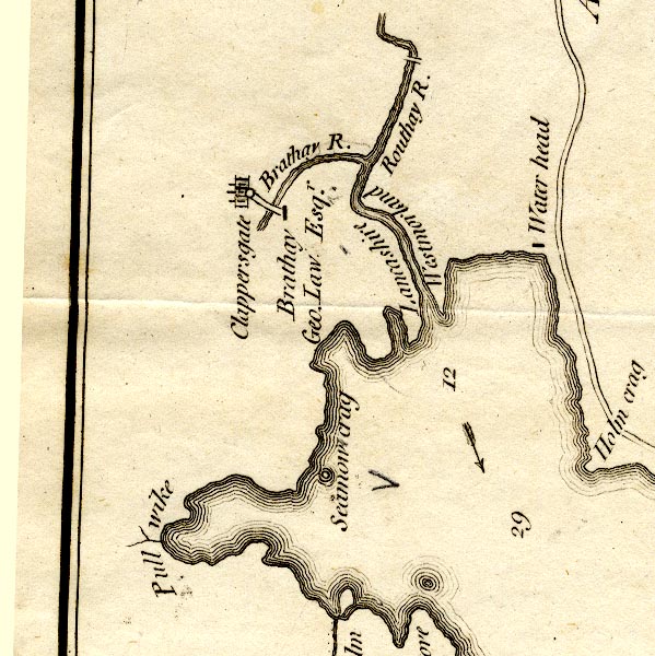 CT9NY30R.jpg "Pull wike" bay item:- Armitt Library : 2008.14.102 Image © see bottom of page |
|
|
|
||
| evidence:- | old map:- Clarke 1787 map (Windermere N) placename:- Pull Wych |
|
| source data:- | Map, A Map of the Northern Part of the Lake Winandermere and its
Environs, scale about 6.5 ins to 1 mile, by James Clarke,
engraved by Samuel John Neele, 352 Strand, published by James
Clarke, Penrith, Cumberland and in London etc, 1787.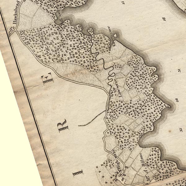 CLANY30Q.jpg "Pull wych" item:- private collection : 10.10 Image © see bottom of page |
|
|
|
||
| evidence:- | old text:- Martineau 1855 placename:- Pullwyke item:- flower; lily of the valley |
|
| source data:- | Guide book, A Complete Guide to the English Lakes, by Harriet
Martineau, published by John Garnett, Windermere, Westmorland,
and by Whittaker and Co, London, 1855; published 1855-76. goto source goto sourcePage 19:- "... Wray Castle, ... Just above it, Pullwyke bay, where lily of the valley is found, runs far into the land; ..." |
|
|
|
||
| evidence:- | old map:- Prior 1874 map 1 placename:- Pull Wyke |
|
| source data:- | Map, uncoloured engraving or lithograph? Winander Mere, scale
about 2.5 miles to 1 inch, published by John Garnett,
Windermere, Westmorland, 1874. click to enlarge click to enlargePI03M1.jpg "Pull Wyke" bay item:- private collection : 133.1 Image © see bottom of page |
|
|
|
||
Lakes Guides menu.