 Old Cumbria Gazetteer
 |
 |
|
| Old Corpse Road, Shap Rural | ||
| Old Corpse Road | ||
| locality:- | Selside Pike | |
| locality:- | Mardale Common | |
| locality:- | Mardale | |
| civil parish:- | Shap Rural (formerly Westmorland) | |
| county:- | Cumbria | |
| locality type:- | corpse road | |
| locality type:- | track | |
| coordinates:- | NY492122 (etc) | |
| 1Km square:- | NY4912 | |
| 10Km square:- | NY41 | |
|
|
||
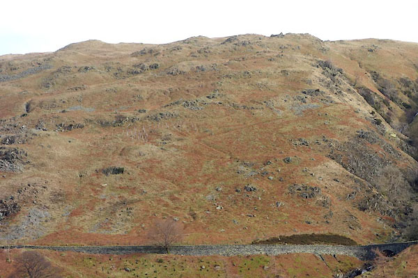 BZW69.jpg (taken 10.2.2014) 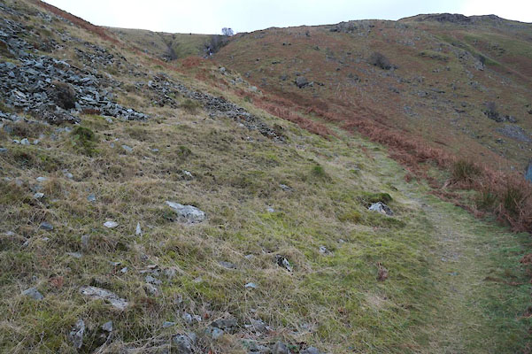 BZT14.jpg At the Mardale end, (taken 28.12.2013) |
||
|
|
||
| evidence:- | old map:- Jefferys 1770 (Wmd) |
|
| source data:- | Map, 4 sheets, The County of Westmoreland, scale 1 inch to 1
mile, surveyed 1768, and engraved and published by Thomas
Jefferys, London, 1770.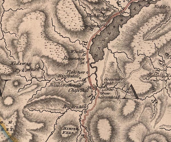 J5NY41SE.jpg 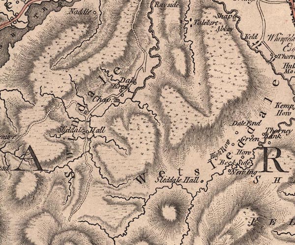 J5NY51SW.jpg track to Swindale item:- National Library of Scotland : EME.s.47 Images © National Library of Scotland |
|
|
|
||
| evidence:- | old map:- Cary 1789 (edn 1805) |
|
| source data:- | Map, uncoloured engraving, Westmoreland, scale about 2.5 miles
to 1 inch, by John Cary, London, 1789; edition 1805.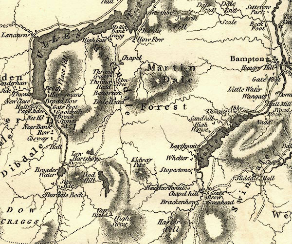 CY24NY41.jpg 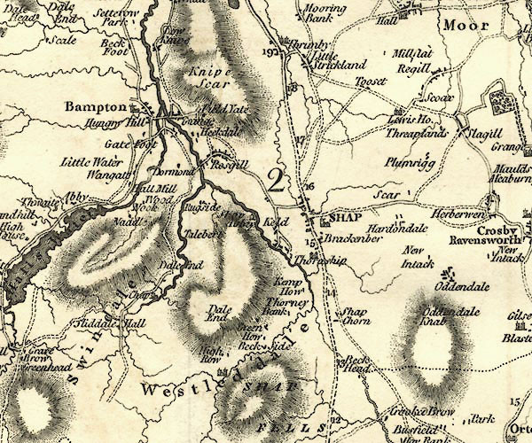 CY24NY51.jpg track, from Mardale, towards Shap item:- JandMN : 129 Image © see bottom of page |
|
|
|
||
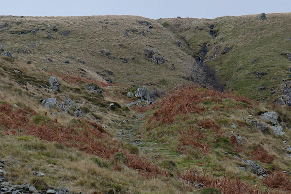 BZT15.jpg At the Mardale end, (taken 28.12.2013) |
||
|
|
||
| story:- |
Before 1728 the chapel at Mardale was not licenced for baptisms, marriages or burials.
The dead of Mardale had to be taken to Shap, and the corpse road was the route over
Selside Pike into Swindale, and thence to Shap. This is a rough path; foot and horse
only. |
|
| The corpse of one man from Mardale, said to have been a bad character, was being taken
over the fell road when a thunderstorm frightened the horse on which his coffin was
tied. The horse bolted, and evaded capture for three months. Eventually it was caught
and the man buried at Shap. |
||
| The last man carried over the corpse road was John Holme of Brackenhow, 17 June 1736. |
||
|
|
||
| continues as:- |  Kirkgate, Swindale Kirkgate, Swindale |
|
|
|
||
Lakes Guides menu.