 Old Cumbria Gazetteer
 |
 |
|
| Nan Bield Pass, Shap Rural | ||
| Nan Bield Pass | ||
| civil parish:- | Shap Rural (formerly Westmorland) | |
| civil parish:- | Kentmere (formerly Westmorland) | |
| county:- | Cumbria | |
| locality type:- | pass | |
| coordinates:- | NY452096 | |
| 1Km square:- | NY4509 | |
| 10Km square:- | NY40 | |
| altitude:- | 2125 feet (approx) | |
| altitude:- | 648m (approx) | |
|
|
||
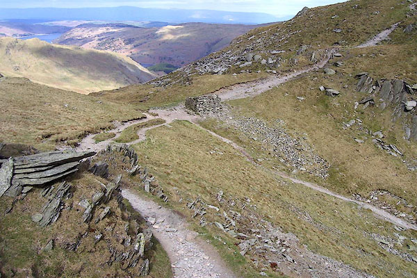
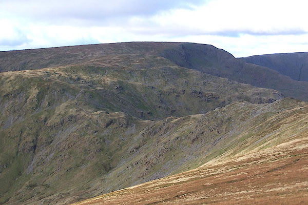 BPV12.jpg Mardale Ill Bell behind. (taken 17.11.2008) 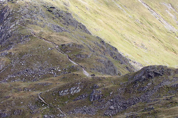 BNP01.jpg Descending from the E. (taken 18.4.2007) |
||
|
|
||
| evidence:- | old map:- Jefferys 1770 (Wmd) placename:- Nan Bield |
|
| source data:- | Map, 4 sheets, The County of Westmoreland, scale 1 inch to 1
mile, surveyed 1768, and engraved and published by Thomas
Jefferys, London, 1770.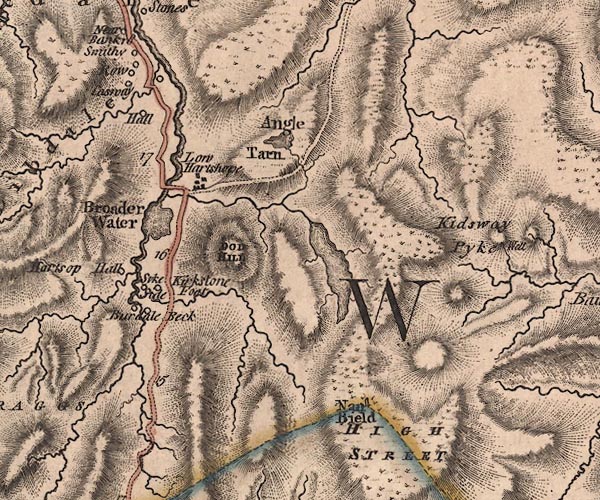 J5NY41SW.jpg "Nan Bield" a standing stone, on a ?ward boundary item:- National Library of Scotland : EME.s.47 Image © National Library of Scotland |
|
|
|
||
| evidence:- | old map:- Cary 1789 (edn 1805) placename:- Van Bield |
|
| source data:- | Map, uncoloured engraving, Westmoreland, scale about 2.5 miles
to 1 inch, by John Cary, London, 1789; edition 1805.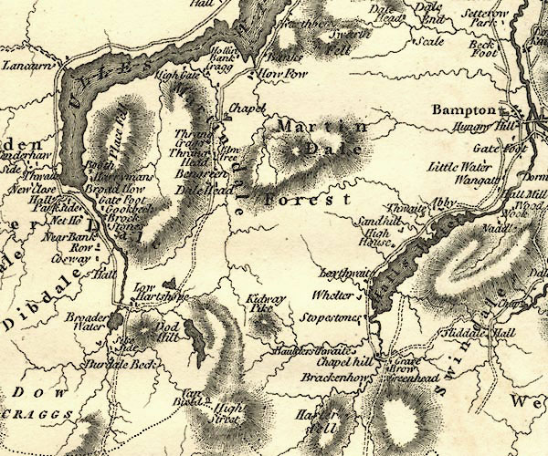 CY24NY41.jpg "Van Bield" stone (in the wrong place) item:- JandMN : 129 Image © see bottom of page |
|
|
|
||
| evidence:- | descriptive text:- Otley 1823 (5th edn 1834) placename:- Nan Bield item:- horse |
|
| source data:- | Guide book, A Concise Description of the English Lakes, the
mountains in their vicinity, and the roads by which they may be
visited, with remarks on the mineralogy and geology of the
district, by Jonathan Otley, published by the author, Keswick,
Cumberland now Cumbria, by J Richardson, London, and by Arthur
Foster, Kirkby Lonsdale, Cumbria, 1823; published 1823-49,
latterly as the Descriptive Guide to the English Lakes. goto source goto sourcePage 35:- "Small Water, rightly named, lies between Harter fell and High Street; and is passed by a mountain track leading from Kentmere to Mardale, over the hause called Nan Bield. ..." goto sourcePage 115:- "...The road over Gatescarth, ... is steep on both sides, yet such as a horse may be ridden, or rather led; ... The pass from Kentmere, over Nan Bield between Harter Fell and High Street, is still more difficult." |
|
|
|
||
| evidence:- | old map:- Garnett 1850s-60s H placename:- Nan Bield |
|
| source data:- | Map of the English Lakes, in Cumberland, Westmorland and
Lancashire, scale about 3.5 miles to 1 inch, published by John
Garnett, Windermere, Westmorland, 1850s-60s.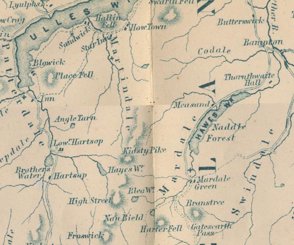 GAR2NY41.jpg "Nan Bield" pass between hachures item:- JandMN : 82.1 Image © see bottom of page |
|
|
|
||
| evidence:- | old print:- MacBride 1922 placename:- Nan Bield Pass |
|
| source data:- | Print, colour, Nan Bield Pass and Small Water Tarn, Mardale, by Alfred Heaton Cooper,
published by Adam and Charles Black, 4-6 Soho Square, London, 2nd edn 1928.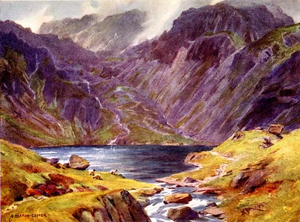 click to enlarge click to enlargeMB0103.jpg Tipped in opposite p.12 in Wild Lakeland by MacKenzie MacBride. printed at bottom:- "NAN BIELD PASS AND SMALL WATER TARN, MARDALE" signed at lower right:- "A. HEATON COOPER" item:- JandMN : 195.5 Image © see bottom of page |
|
|
|
||
| evidence:- | outline view:- Black 1856 (23rd edn 1900) placename:- Nan Bield and Pass |
|
| source data:- | Print, lithograph, Outline Views, Haws and Wastwater - Mountains as seen from Burn-Banks
near the Foot of Hawes Water, and Mountains as seen near Nether Wastdale at the First
Bridge on the road to Wast-Water, by J Flintoft, Keswick, Cumberland, engraved by
R Mason, Edinburgh, Lothian, about 1900.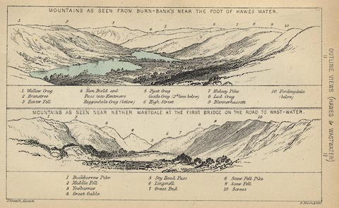 click to enlarge click to enlargeBC08E6.jpg "... 4 Nan Bield and Pass into Kentmere ..." item:- JandMN : 37.21 Image © see bottom of page |
|
|
|
||
| evidence:- | outline view:- Black 1841 (3rd edn 1846) placename:- Nan Bield and Pass |
|
| source data:- | Print, engraving, outline view, Mountains as seen from Burn Banks near the Foot of
Hawes Water, and Mountains as seen near Strands in Wastdale at the First bridge on
the Road to Wast Water, by J Flintoft, Keswick, Cumberland, engraved by R Mason, Edinburgh,
Lothian, about 1846.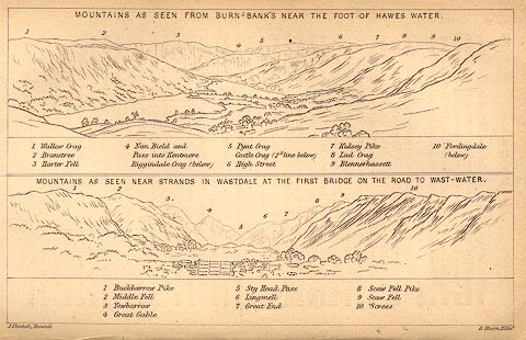 click to enlarge click to enlargeBC02E8.jpg "... 4 Nan Bield and Pass into Kentmere ..." item:- JandMN : 32.12 Image © see bottom of page |
|
|
|
||
 BNP02.jpg Descending from the E. (taken 18.4.2007) 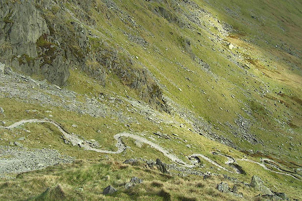 BNP03.jpg The path wiggling down to Kentmere. (taken 18.4.2007) 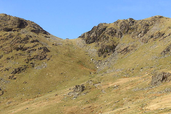 BNP04.jpg From the S. (taken 18.4.2007) |
||
|
|
||
Lakes Guides menu.