 |
 |
|
|
|
|
Murrah |
| civil parish:- |
Mungrisdale (formerly Cumberland) |
| county:- |
Cumbria |
| locality type:- |
locality |
| locality type:- |
buildings |
| coordinates:- |
NY37853144 (etc) |
| 1Km square:- |
NY3731 |
| 10Km square:- |
NY33 |
|
|
| evidence:- |
old map:- OS County Series (Cmd 57 3)
placename:- Murrah
|
| source data:- |
Maps, County Series maps of Great Britain, scales 6 and 25
inches to 1 mile, published by the Ordnance Survey, Southampton,
Hampshire, from about 1863 to 1948.
|
|
|
| evidence:- |
old map:- Donald 1774 (Cmd)
placename:- Murrah
|
| source data:- |
Map, hand coloured engraving, 3x2 sheets, The County of Cumberland, scale about 1
inch to 1 mile, by Thomas Donald, engraved and published by Joseph Hodskinson, 29
Arundel Street, Strand, London, 1774.
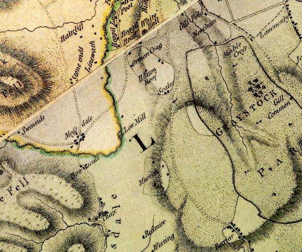
D4NY33SE.jpg
"Murrah"
block or blocks, labelled in lowercase; a hamlet or just a house
item:- Carlisle Library : Map 2
Image © Carlisle Library |
|
|
| places:- |
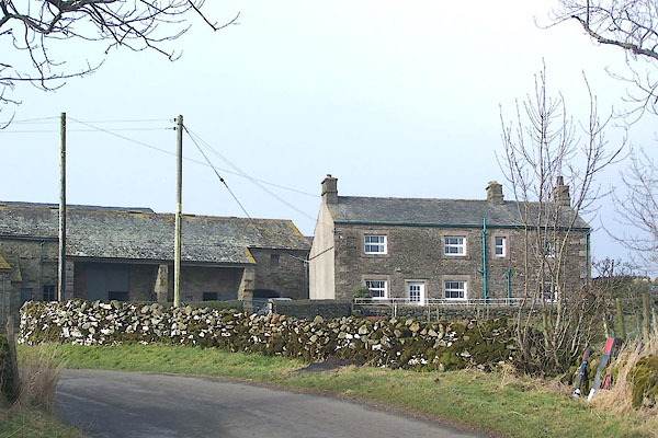 |
NY38043138 High Murrah (Mungrisdale) |
|
|
 |
NY38093188 limekiln, Murrah (Mungrisdale) |
|
|
|
NY38153119 limekiln, Murrah (2) (Mungrisdale) |
|
|
|
NY37823113 Low Murrah (Mungrisdale) |
|
|
|
NY37533161 Low Murrah (Mungrisdale) |
|
|
|
NY37803163 Murrah Hall (Mungrisdale) |
|
|
|
NY37923193 Sureset Spring (Mungrisdale) |
|
