 Old Cumbria Gazetteer
 |
 |
|
| milestone, Upper Allithwaite (4) | ||
| locality:- | Lindale | |
| civil parish:- | Upper Allithwaite (formerly Lancashire) | |
| county:- | Cumbria | |
| locality type:- | milestone | |
| coordinates:- | SD41948040 | |
| 1Km square:- | SD4180 | |
| 10Km square:- | SD48 | |
|
|
||
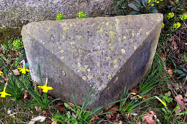 BLW19.jpg Inscribed stone, grubby:- "ALLITHWAITE UPPER / TO GRANGE 2 MILES ULVERSTON 14 M / TO KENDAL 12 MILES LANCASTER 28" (taken 19.4.2006) |
||
|
|
||
| evidence:- | old map:- OS County Series (Lan 13) |
|
| source data:- | Maps, County Series maps of Great Britain, scales 6 and 25
inches to 1 mile, published by the Ordnance Survey, Southampton,
Hampshire, from about 1863 to 1948. "M.S. ULVERSTON [ ] MILNTHORPE [ ]" |
|
|
|
||
 Lakes Guides menu.