 Old Cumbria Gazetteer
 |
 |
|
| Hesket Bridge, Hesket Newmarket | ||
| Hesket Bridge | ||
| site name:- | Caldew, River | |
| locality:- | Hesket Newmarket | |
| civil parish:- | Caldbeck (formerly Cumberland) | |
| civil parish:- | Castle Sowerby (formerly Cumberland) | |
| county:- | Cumbria | |
| locality type:- | packhorse bridge (?) | |
| locality type:- | bridge | |
| coordinates:- | NY34313886 | |
| 1Km square:- | NY3438 | |
| 10Km square:- | NY33 | |
|
|
||
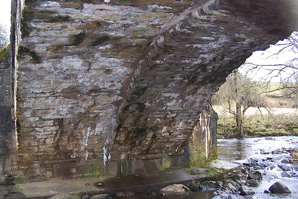
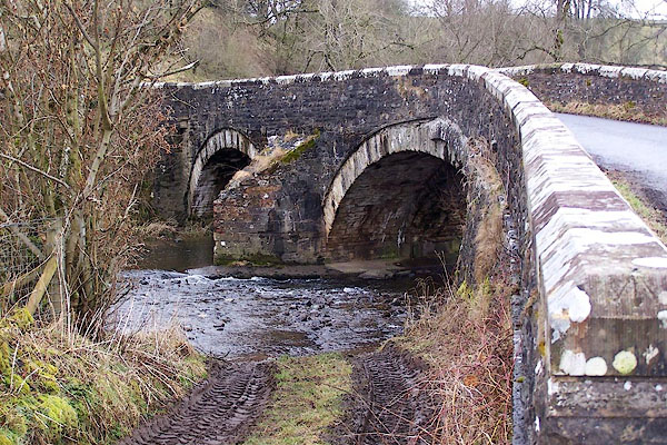 BLR45.jpg (taken 9.3.2006) 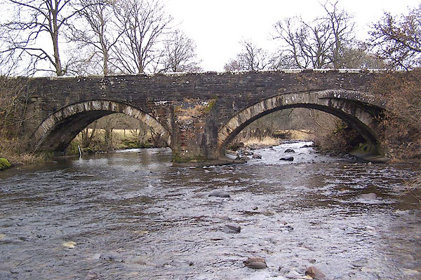 BLR47.jpg (taken 9.3.2006) |
||
|
|
||
| evidence:- | old map:- OS County Series (Cmd 38 13) placename:- Hesket Bridge |
|
| source data:- | Maps, County Series maps of Great Britain, scales 6 and 25
inches to 1 mile, published by the Ordnance Survey, Southampton,
Hampshire, from about 1863 to 1948. |
|
|
|
||
| evidence:- | old map:- Donald 1774 (Cmd) |
|
| source data:- | Map, hand coloured engraving, 3x2 sheets, The County of Cumberland, scale about 1
inch to 1 mile, by Thomas Donald, engraved and published by Joseph Hodskinson, 29
Arundel Street, Strand, London, 1774.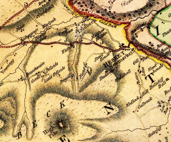 D4NY33NW.jpg double line across a river; a bridge over the Caldew at Hesket Newmarket item:- Carlisle Library : Map 2 Image © Carlisle Library |
|
|
|
||
| evidence:- | old map:- Bell 1892 placename:- Hesket New Market Bridge |
|
| source data:- | Map, colour lithograph, Road Map of Cumberland, by George Joseph
Bell, scale about 2.5 miles to 1 inch, printed by Charles
Thurnam and Sons, Carlisle, Cumberland, 1892.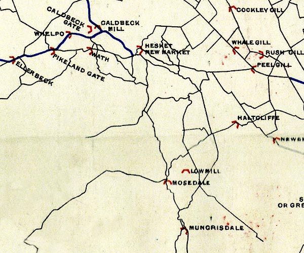 BEL9NY33.jpg "HESKET NEW MARKET" bridge symbol Road map of Cumberland showing County Bridges item:- Carlisle Library : Map 38 Image © Carlisle Library |
|
|
|
||
| evidence:- | database:- Listed Buildings 2010 placename:- Hesket Bridge |
|
| source data:- | courtesy of English Heritage "HESKET BRIDGE / / / CALDBECK / ALLERDALE / CUMBRIA / II / 72406 / NY3431338862" |
|
| source data:- | courtesy of English Heritage "HESKET BRIDGE / / / CASTLE SOWERBY / EDEN / CUMBRIA / II / 73729 / NY3431638862" |
|
| source data:- | courtesy of English Heritage "Roadbridge. Probably mid C18 with C19 widening and C20 rebuilt parapets. Coursed limestone rubble. 2 segmental arches on central pier with pointed cutwaters under solid parapet with chamfered coping. Underside of arches shows bridge was originally of single-track width. See E. Jervoise, Ancient Bridges of the North of England, 1931 p117 illustration and p120." |
|
|
|
||
 BLR46.jpg The bridge has been widened; it is still pretty narrow. (taken 9.3.2006) 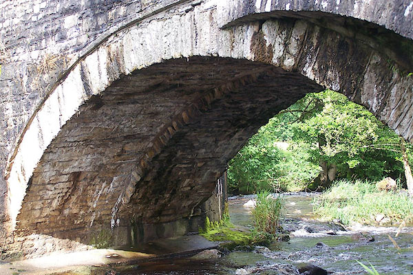 BNY04.jpg The bridge has been widened; it is still pretty narrow. (taken 15.8.2007) |
||
|
|
||
 Lakes Guides menu.