Old Cumbria Gazetteer
 |
 |
|
||
| Greenhead Gill | ||||
| runs into:- |  Rothay, River Rothay, River |
|||
|
|
||||
| civil parish:- | Lakes (formerly Westmorland) | |||
| county:- | Cumbria | |||
| locality type:- | river | |||
| 1Km square:- | NY3408 | |||
| 10Km square:- | NY30 | |||
|
|
||||
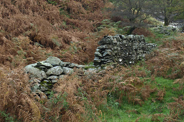
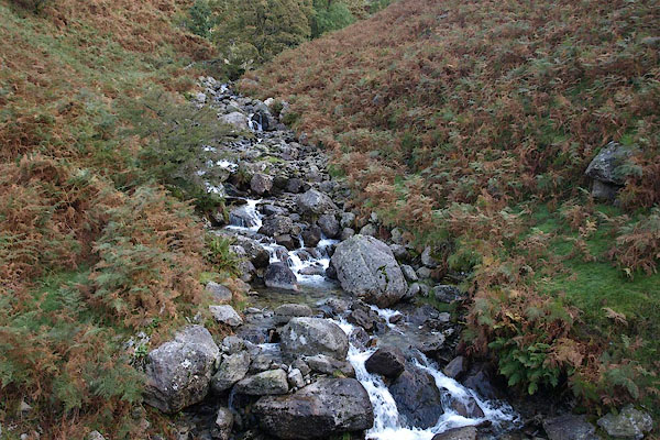 BRR41.jpg At the Thirlmere aqueduct, (taken 7.10.2009)  BRS24.jpg (taken 7.10.2009) |
||||
|
|
||||
| evidence:- | old map:- OS County Series (Wmd 19 13) placename:- Greenhead Gill |
|||
| source data:- | Maps, County Series maps of Great Britain, scales 6 and 25
inches to 1 mile, published by the Ordnance Survey, Southampton,
Hampshire, from about 1863 to 1948. |
|||
|
|
||||
| evidence:- | old map:- Ogilby 1675 (plate 96) |
|||
| source data:- | Road strip map, hand coloured engraving, the Road from Kendal to
Cockermouth, and the Road from Egremond to Carlisle, scale about
1 inch to 1 mile, by John Ogilby, London, 1675.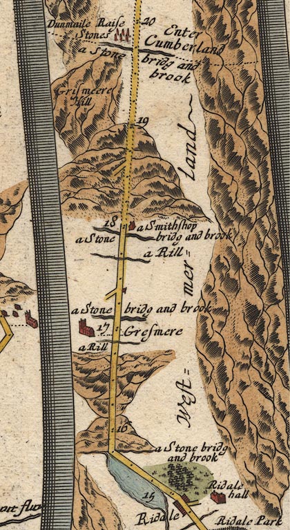 OG96m015.jpg In mile 17, Westmerland. River crossed at:- "a Stone bridg and brook" no bridge drawn. item:- JandMN : 22 Image © see bottom of page |
|||
|
|
||||
| evidence:- | possibly old print:- Green 1810 (plate 26) placename:- Bramerigg Gill |
|||
| source data:- | Print, soft ground etching, Bramerigg Gill, Westmorland? by William Green, Ambleside,
Westmorland, 1808.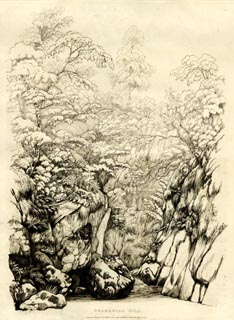 click to enlarge click to enlargeGN1226.jpg Plate 26 in Sixty Studies from Nature, 1810. printed at top right:- "26" printed at bottom:- "BRAMERIGG GILL. / Drawn and Engraved by William Green, and Published at Ambleside, June 24, 1808." watermark:- "J WHATMAN / 1813" item:- Armitt Library : A6641.26 Image © see bottom of page |
|||
|
|
||||
| evidence:- | outline view:- Otley 1823 (5th edn 1834) placename:- Greenhead Ghyll |
|||
| source data:- | Print, woodcut outline view, The Mountains of Grasmere and
Rydal, by Jonathan Otley, Keswick, Cumberland, 1830.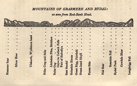 click to enlarge click to enlargeOT2E03.jpg Printed on p.15 of A Concise Description of the English Lakes, by Jonathan Otley, 5th edition, 1834. "MOUNTAINS OF GRASMERE AND RYDAL: as seen from Red-Bank Head." "Hammer Scar / Silver How / Ullskarth, Wythburn head / Helm Crag and Stile / Littledale Pike, Skiddaw / Raise Gap / Calva in Caldbeck Fells / Part of Helvellyn / Seat Sandal / Grisedale Hause / Great Rigg, Fairfield / Green-head Ghyll / Forest Side / Nab Scar / Scandale Fell / Rydal Park / Cawdale Moor / Loughrigg Fell" item:- JandMN : 48.4 Image © see bottom of page |
|||
|
|
||||
| evidence:- | old print:- Robertson 1911 placename:- Green Head Ghyll |
|||
| source data:- | Print, lithograph? Green Head Ghyll, from a watercolour by Arthur Tucker, published
by Chatto and Windus, London, 1911. click to enlarge click to enlargeRSN141.jpg Tipped in opposite p.268 of Wordsworthshire by Eric Robertson. With Michael's Fold in the foreground? printed at bottom:- "GREEN-HEAD GHYLL / (Site of Michael's sheepfold)" signed at painting lower left:- "Arthur Tucker" item:- JandMN : 197.45 Image © see bottom of page |
|||
|
|
||||
| evidence:- | old print:- Goodwin 1887 (edn 1890) placename:- Green Head Ghyll |
|||
| source data:- | Print, etching? Green Head Ghyll, Westmorland, by Harry Goodwin, published by Swan
Sonnenschein and Co, Paternoster Square, London, 1890. click to enlarge click to enlargePR1592.jpg Tipped in opposite p.104 of Through the Wordsworth Country, by William Knight. printed at lower right:- "HG" item:- JandMN : 382.22 Image © see bottom of page |
|||
|
|
||||
| evidence:- | outline view:- Black 1856 (23rd edn 1900) placename:- Greenhead Ghyll |
|||
| source data:- | Print, lithograph, Outline Views, Grasmere and Coniston - Mountains as seen from Redbank,
Grasmere, and Mountains as seen a little beyond Tent Lodge on the Road from Coniston
to Ulverstone, by J Flintoft, Keswick, Cumberland, engraved by R Mason, Edinburgh,
Lothian, about 1900.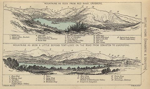 click to enlarge click to enlargeBC08E3.jpg "... 13 Grenn-head Ghyll ..." item:- JandMN : 37.12 Image © see bottom of page |
|||
|
|
||||
| evidence:- | outline view:- Black 1841 (3rd edn 1846) placename:- Greenhead Ghyll |
|||
| source data:- | Print, engraving, outline view, Mountains as seen from Red Bank, Grasmere, and Mountains
as seen a little beyond Tent-Lodge on the Road from Coniston to Ulverston, by J Flintoft,
Keswick, Cumberland, engraved by R Mason, Edinburgh, Lothian, about 1846.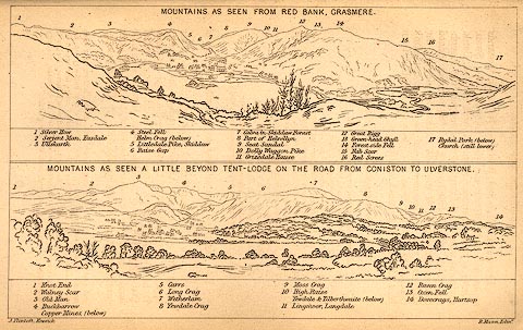 click to enlarge click to enlargeBC02E3.jpg "... 13 Green-head Ghyll ..." item:- JandMN : 32.5 Image © see bottom of page |
|||
|
|
||||
| notes:- |
James Payn and a geological friend went up the gill, and the latter found a lump of
yellow heavy metal in the stream bed, declaring ot to be gold. The novelist commandeered
it and threw it away as an impediment. Next year they read in The Times that a government
commission reported finding gold in the Lake District, though in very small quantities,
most abundantly on Greenhead Fell. |
|||
| Baron 1925 |
||||
|
|
||||
| places:- |
|
|||
|
||||
|
||||
|
||||
|
||||
Lakes Guides menu.