 Old Cumbria Gazetteer
 |
 |
|
| Great Mell Fell, Hutton | ||
| Great Mell Fell | ||
| civil parish:- | Hutton (formerly Cumberland) | |
| county:- | Cumbria | |
| locality type:- | hill | |
| coordinates:- | NY39672538 (etc) | |
| 1Km square:- | NY3925 | |
| 10Km square:- | NY32 | |
| altitude:- | 1760 feet | |
| altitude:- | 536m | |
|
|
||
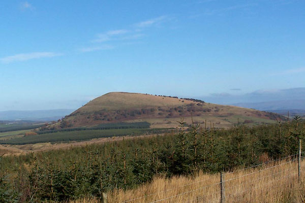 BXP07.jpg (taken 27.10.2012) 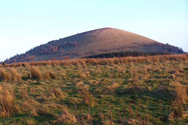 BNE95.jpg From NW. (taken 17.2.2007) |
||
|
|
||
| evidence:- | old map:- OS County Series (Cmd 57 15) placename:- Great Mell Fell placename:- Mell Fell, Great |
|
| source data:- | Maps, County Series maps of Great Britain, scales 6 and 25
inches to 1 mile, published by the Ordnance Survey, Southampton,
Hampshire, from about 1863 to 1948. |
|
|
|
||
| evidence:- | old map:- Donald 1774 (Cmd) placename:- Mell Fell |
|
| source data:- | Map, hand coloured engraving, 3x2 sheets, The County of Cumberland, scale about 1
inch to 1 mile, by Thomas Donald, engraved and published by Joseph Hodskinson, 29
Arundel Street, Strand, London, 1774.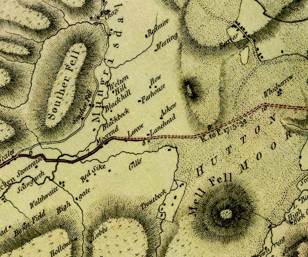 D4NY32NE.jpg "Mell Fell" hill hachuring; a hill or mountain item:- Carlisle Library : Map 2 Image © Carlisle Library |
|
|
|
||
| evidence:- | old text:- Clarke 1787 placename:- Mell fell |
|
| source data:- | Guide book, A Survey of the Lakes of Cumberland, Westmorland,
and Lancashire, written and published by James Clarke, Penrith,
Cumberland, and in London etc, 1787; published 1787-93. goto source goto sourcePage 54:- "... On the left is Mell-Fell, a beautiful, smooth, verdant mountain, of a shape almost conical, ..." |
|
|
|
||
| evidence:- | old print:- Clarke 1787 placename:- Great Mellfell |
|
| source data:- | circle click to enlarge click to enlargeCL18.jpg "Great Mellfell" item:- Armitt Library : A6615.12 Image © see bottom of page |
|
|
|
||
| evidence:- | old map:- Otley 1818 placename:- Mell Fell |
|
| source data:- | Map, uncoloured engraving, The District of the Lakes,
Cumberland, Westmorland, and Lancashire, scale about 4 miles to
1 inch, by Jonathan Otley, 1818, engraved by J and G Menzies,
Edinburgh, Scotland, published by Jonathan Otley, Keswick,
Cumberland, et al, 1833.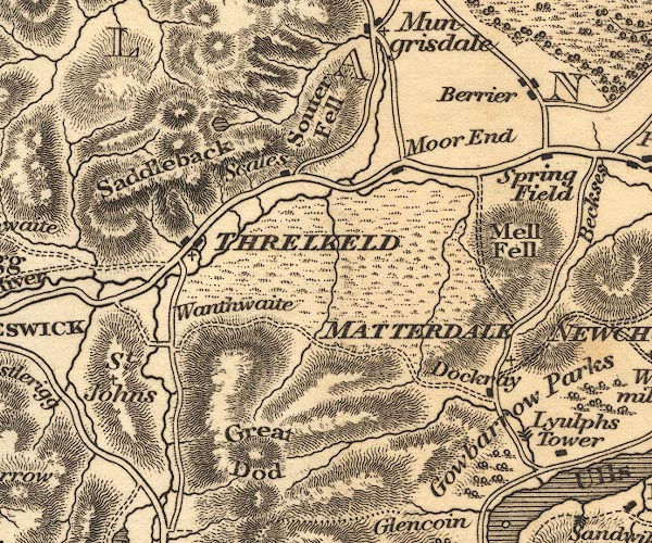 OT02NY32.jpg item:- JandMN : 48.1 Image © see bottom of page |
|
|
|
||
| evidence:- | perhaps (height wrong) descriptive text:- Otley 1823 (5th edn 1834) item:- geology |
|
| source data:- | Guide book, A Concise Description of the English Lakes, the
mountains in their vicinity, and the roads by which they may be
visited, with remarks on the mineralogy and geology of the
district, by Jonathan Otley, published by the author, Keswick,
Cumberland now Cumbria, by J Richardson, London, and by Arthur
Foster, Kirkby Lonsdale, Cumbria, 1823; published 1823-49,
latterly as the Descriptive Guide to the English Lakes. goto source Page 160:- "..." "A conglomerate, composed of rounded stones of various sizes, from the smallest gravel, to the weight of several pounds, held together by a ferruginous, calcareous cement, forms a hill of a parabolic shape, about 1200 feet in height, called Mell Fell; and some lesser elevations extending to the foot of Ullswater. These pebbles are apparently fragments of older rocks, rounded by attrition, and must have been transported from some distance, as their composition does not correspond with the rocks of the" goto sourcePage 161:- "neighbourhood. This has been taken by some to belong to the old red sandstone formation; but whether it passes under or only abuts against the adjacent limestone, I have not yet myself had an opportunity of observing; but have been told that their junction may be seen near Shap Abbey; and in a quarry near Greystoke. ..." |
|
|
|
||
| evidence:- | old map:- Ford 1839 map placename:- Mell Fell |
|
| source data:- | Map, uncoloured engraving, Map of the Lake District of
Cumberland, Westmoreland and Lancashire, scale about 3.5 miles
to 1 inch, published by Charles Thurnam, Carlisle, and by R
Groombridge, 5 Paternoster Row, London, 3rd edn 1843.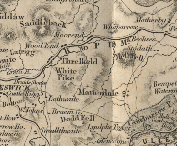 FD02NY32.jpg "Mell Fell" Hill hachuring. item:- JandMN : 100.1 Image © see bottom of page |
|
|
|
||
| evidence:- | old map:- Garnett 1850s-60s H placename:- Mell Fell |
|
| source data:- | Map of the English Lakes, in Cumberland, Westmorland and
Lancashire, scale about 3.5 miles to 1 inch, published by John
Garnett, Windermere, Westmorland, 1850s-60s.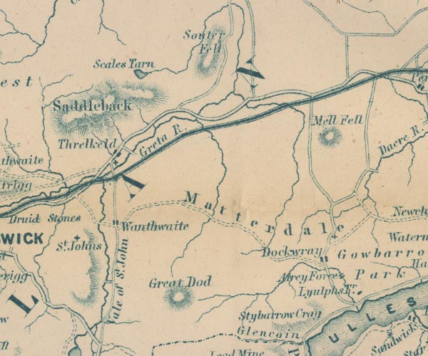 GAR2NY32.jpg "Mell Fell" hill hachuring item:- JandMN : 82.1 Image © see bottom of page |
|
|
|
||
| evidence:- | old text:- Martineau 1855 placename:- Mell Fell item:- larch |
|
| source data:- | Guide book, A Complete Guide to the English Lakes, by Harriet
Martineau, published by John Garnett, Windermere, Westmorland,
and by Whittaker and Co, London, 1855; published 1855-76. goto source Page 104:- "... Mell Fell, the ugliest of hills,- like a tumulus planted all over with larch, grows larger as the traveller proceeds, till he finds he is to make a sharp turn to the right, and pass directly under it. Judging from our own experience, we should say that this part of the journey is always broiling hot or bitterly cold. ..." |
|
|
|
||
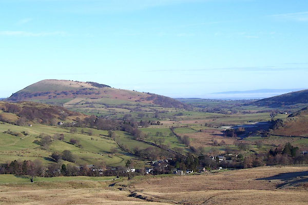 BND97.jpg Dockray and Great Mell Fell. (taken 5.2.2007) 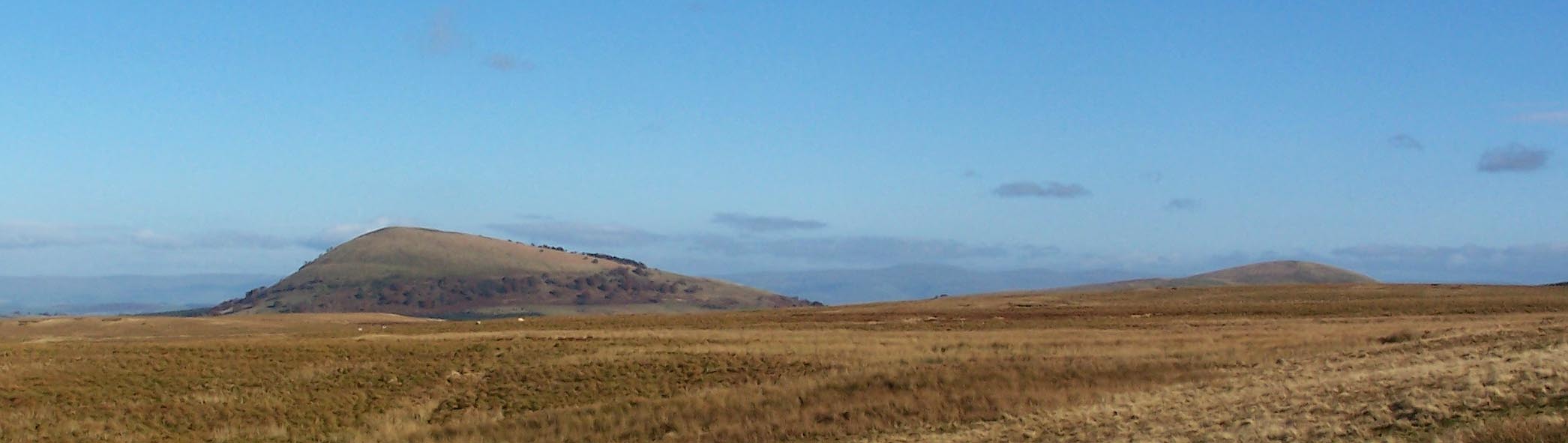 Click to enlarge BXP08.jpg Great Mell Fell and Little Mell Fell. (taken 27.10.2012) |
||
|
|
||
| hearsay:- |
It is said that the last wild cat in Cumbria was killed on Great Mell Fell in the
mid 19th century. A fearsome and aggressive beast that attacked man and sheep. |
|
|
|
||
Lakes Guides menu.