 Old Cumbria Gazetteer
 |
 |
|
| Dovenby Mill, Bridekirk | ||
| Dovenby Mill | ||
| site name:- | Brides Beck | |
| civil parish:- | Bridekirk (formerly Cumberland) | |
| county:- | Cumbria | |
| locality type:- | buildings | |
| locality type:- | water mill | |
| locality type:- | saw mill (once) | |
| locality type:- | corn mill (once) | |
| coordinates:- | NY10443327 | |
| 1Km square:- | NY1033 | |
| 10Km square:- | NY13 | |
|
|
||
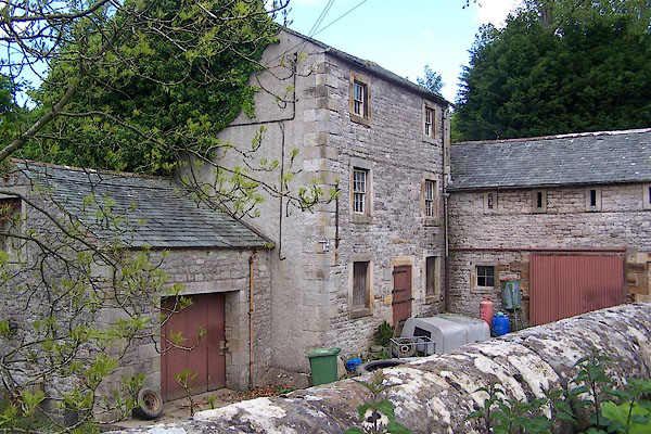 BNR83.jpg (taken 25.5.2007) |
||
|
|
||
| evidence:- | old map:- OS County Series (Cmd 45 15) placename:- Dovenby Mill |
|
| source data:- | Maps, County Series maps of Great Britain, scales 6 and 25
inches to 1 mile, published by the Ordnance Survey, Southampton,
Hampshire, from about 1863 to 1948. "Dovenby Mill (Corn) / Mill Race / Dam" |
|
|
|
||
| evidence:- | database:- Listed Buildings 2010 placename:- Dovenby Mill |
|
| source data:- | courtesy of English Heritage "DOVENBY MILL / / / BRIDEKIRK / ALLERDALE / CUMBRIA / II / 72588 / NY1044233270" |
|
|
|
||
 Lakes Guides menu.