Old Cumbria Gazetteer
 |
 |
|
||
| Croglin Water | ||||
| runs into:- |  Eden, River Eden, River |
|||
|
|
||||
| civil parish:- | Kirkoswald (formerly Cumberland) | |||
| civil parish:- | Ainstable (formerly Cumberland) | |||
| civil parish:- | Alston Moor (formerly Cumberland) | |||
| county:- | Cumbria | |||
| locality type:- | river | |||
| locality type:- | boundary | |||
| locality type:- | parish boundary | |||
| 1Km square:- | NY5746 (etc) | |||
| 10Km square:- | NY54 | |||
|
|
||||
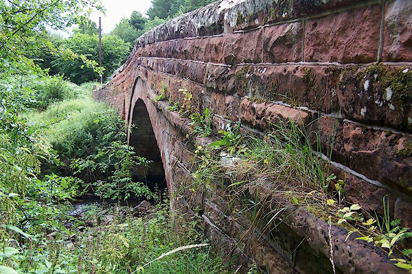
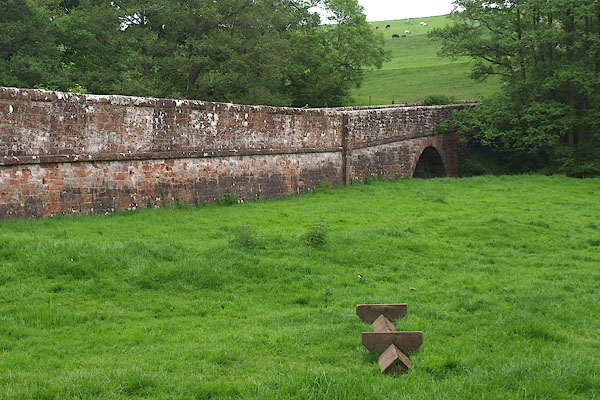
 BPH24.jpg At Dale Bridge. (taken 30.5.2008)  BMM39.jpg At Croglin Bridge. (taken 11.8.2006) |
||||
|
|
||||
| evidence:- | old map:- OS County Series (Cmd 32 8) placename:- Croglin Water |
|||
| source data:- | Maps, County Series maps of Great Britain, scales 6 and 25
inches to 1 mile, published by the Ordnance Survey, Southampton,
Hampshire, from about 1863 to 1948. OS County Series (Cmd 32 10) OS County Series (Cmd 32 11) OS County Series (Cmd 33 14) OS County Series (Cmd 40 2) |
|||
|
|
||||
| evidence:- | old map:- Saxton 1579 |
|||
| source data:- | Map, hand coloured engraving, Westmorlandiae et Cumberlandiae Comitatus ie Westmorland
and Cumberland, scale about 5 miles to 1 inch, by Christopher Saxton, London, engraved
by Augustinus Ryther, 1576, published 1579-1645. Sax9NY54.jpg item:- private collection : 2 Image © see bottom of page |
|||
|
|
||||
| evidence:- | old map:- Speed 1611 (Cmd) |
|||
| source data:- | Map, hand coloured engraving, Cumberland and the Ancient Citie
Carlile Described, scale about 4 miles to 1 inch, by John Speed,
1610, published by J Sudbury and George Humble, Popes Head
Alley, London, 1611-12.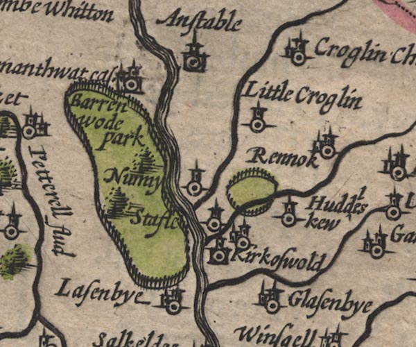 SP11NY54.jpg wiggly line, runs into the Petteril item:- private collection : 16 Image © see bottom of page |
|||
|
|
||||
| evidence:- | old map:- Jansson 1646 |
|||
| source data:- | Map, hand coloured engraving, Cumbria and Westmoria, ie
Cumberland and Westmorland, scale about 3.5 miles to 1 inch, by
John Jansson, Amsterdam, Netherlands, 1646.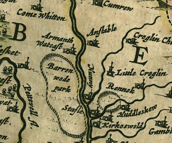 JAN3NY54.jpg Single wiggly line. item:- JandMN : 88 Image © see bottom of page |
|||
|
|
||||
| evidence:- | old map:- Sanson 1679 |
|||
| source data:- | Map, hand coloured engraving, Ancien Royaume de Northumberland
aujourdhuy Provinces de Nort, ie the Ancient Kingdom of
Northumberland or the Northern Provinces, scale about 9.5 miles
to 1 inch, by Nicholas Sanson, Paris, France, 1679. click to enlarge click to enlargeSAN2Cm.jpg tapering wiggly line; river item:- Dove Cottage : 2007.38.15 Image © see bottom of page |
|||
|
|
||||
| evidence:- | old map:- Seller 1694 (Cmd) |
|||
| source data:- | Map, uncoloured engraving, Cumberland, scale about 12 miles to 1
inch, by John Seller, 1694. click to enlarge click to enlargeSEL9.jpg tapering wiggly line; river item:- Dove Cottage : 2007.38.89 Image © see bottom of page |
|||
|
|
||||
| evidence:- | old map:- Morden 1695 (Cmd) |
|||
| source data:- | Map, uncoloured engraving, Cumberland, scale about 4 miles to 1
inch, by Robert Morden, 1695, published by Abel Swale, the
Unicorn, St Paul's Churchyard, Awnsham, and John Churchill, the
Black Swan, Paternoster Row, London, 1695-1715. MD12NY54.jpg Running into the Eden at Nunnery. item:- JandMN : 90 Image © see bottom of page |
|||
|
|
||||
| evidence:- | old map:- Bowen and Kitchin 1760 |
|||
| source data:- | Map, hand coloured engraving, A New Map of the Counties of
Cumberland and Westmoreland Divided into their Respective Wards,
scale about 4 miles to 1 inch, by Emanuel Bowen and Thomas
Kitchin et al, published by T Bowles, Robert Sayer, and John
Bowles, London, 1760. BO18NY54.jpg wiggly line, into the Petterill item:- Armitt Library : 2008.14.10 Image © see bottom of page |
|||
|
|
||||
| evidence:- | old map:- Donald 1774 (Cmd) placename:- Croglin Water |
|||
| source data:- | Map, hand coloured engraving, 3x2 sheets, The County of Cumberland, scale about 1
inch to 1 mile, by Thomas Donald, engraved and published by Joseph Hodskinson, 29
Arundel Street, Strand, London, 1774.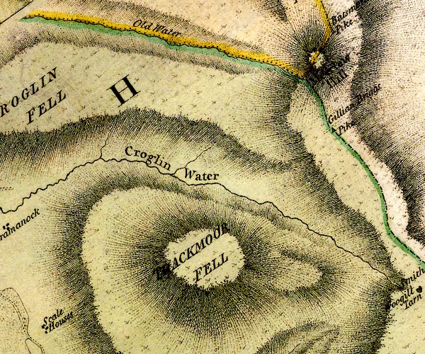 D4NY64NW.jpg "Croglin Water" 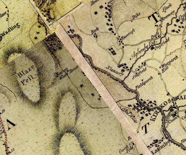 D4NY54SW.jpg single or double wiggly line; a river into the Eden item:- Carlisle Library : Map 2 Images © Carlisle Library |
|||
|
|
||||
| evidence:- | old map:- Cooper 1808 |
|||
| source data:- | Map, uncoloured engraving, Cumberland, scale about 10.5 miles to
1 inch, drawn and engraved by Cooper, published by R Phillips,
Bridge Street, Blackfriars, London, 1808. click to enlarge click to enlargeCOP3.jpg tapering wiggly line; river item:- JandMN : 86 Image © see bottom of page |
|||
|
|
||||
| evidence:- | old map:- Garnett 1850s-60s H placename:- Croglin Water |
|||
| source data:- | Map of the English Lakes, in Cumberland, Westmorland and
Lancashire, scale about 3.5 miles to 1 inch, published by John
Garnett, Windermere, Westmorland, 1850s-60s. GAR2NY55.jpg wiggly line, river 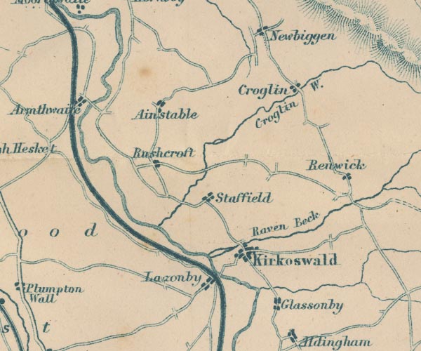 GAR2NY54.jpg "Croglin W." item:- JandMN : 82.1 Image © see bottom of page |
|||
|
|
||||
| evidence:- | old map:- Postlethwaite 1877 (3rd edn 1913) placename:- Croglin Water |
|||
| source data:- | Map, uncoloured engraving, Map of the Lake District Mining Field, Westmorland, Cumberland,
Lancashire, scale about 5 miles to 1 inch, by John Postlethwaite, published by W H
Moss and Sons, 13 Lowther Street, Whitehaven, Cumberland, 1877 edn 1913.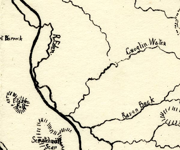 PST2NY54.jpg "Croglin Water" wiggly line, running into the Eden item:- JandMN : 162.2 Image © see bottom of page |
|||
|
|
||||
| evidence:- | old print:- Farington 1816 |
|||
| source data:- | Print, uncoloured engraving, View at Nunnery in Cumberland, painted by J Farington,
engraved by W Birch, published by William Birch, Hampstead Heath, London, 1789.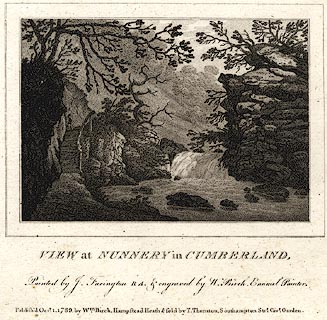 click to enlarge click to enlargePR0104.jpg printed at bottom:- "VIEW at NUNNERY in CUMBERLAND, / Painted by J. Farington R A. & engraved by W. Birch, Enamel Painter. / Publish'd Octr. 1. 1789 by Wm. Birch, Hampstead Heath &sold by T. Thornton, Southampton Strt. Covt. Garden." item:- Dove Cottage : 2008.107.104 Image © see bottom of page |
|||
|
|
||||
| evidence:- | old print with text:- Farington 1816 |
|||
| source data:- | Print, engraving, View at Nunnery, Ainstable, Cumberland, painted by J Farington,
1800s? engraved by Samuel Middiman and John Pye, published by T Cadell and W Davies,
Strand, London, 1816.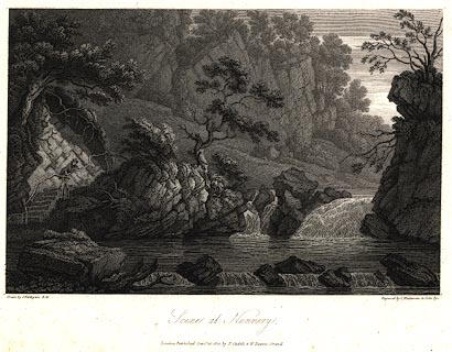 click to enlarge click to enlargePR0001.jpg Presumably Nunnery Walks by the Croglin Water. Plate 34, in The Lakes of Lancashire, Westmorland and Cumberland, by T H Horne, published London, 1816. item:- private collection : 87 Image © see bottom of page |
|||
|
|
||||
| evidence:- | old print with text:- Farington 1816 |
|||
| source data:- | Print, engraving, View at Nunnery, Ainstable, Cumberland now Cumbria, painted by J
Farington, 1810s? engraved by W Birch, mid 19th century.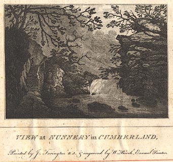 click to enlarge click to enlargeBMZ24.jpg Presumably Nunnery Walks by the Croglin Water. This is presumably a new engraving of the scene, plate 34, in The Lakes of Lancashire, Westmorland and Cumberland, by T H Horne, published London, 1816; with descriptive text:- "Scene at Nunnery in Cumberland. ... Mr. Farington seems to have discovered one [a scene] in this private spot, not much known, yet deserving of the highest attention." "His easy pencil has remembered in the picture all that sweet repose, so engaging in these exhibitions of wild nature." item:- Dove Cottage : Lowther.77 Image © see bottom of page |
|||
|
|
||||
| places:- |
|
|||
|
||||
|
||||
|
||||
|
||||
|
||||
|
||||
Lakes Guides menu.