 Old Cumbria Gazetteer
 |
 |
|
|
| Cockermouth and Workington Railway | |||
| civil parish:- | Brigham (formerly Cumberland) | ||
| civil parish:- | Greysouthen (formerly Cumberland) | ||
| civil parish:- | Little Clifton (formerly Cumberland) | ||
| civil parish:- | Camerton (formerly Cumberland) | ||
| civil parish:- | Great Clifton (formerly Cumberland) | ||
| civil parish:- | Seaton (formerly Cumberland) | ||
| civil parish:- | Workington (formerly Cumberland) | ||
| county:- | Cumbria | ||
| locality type:- | railway | ||
| SummaryText:- | from Cockermouth, through Brigham, Camerton, Workington Bridge, to Workington, Cumberland. | ||
| references:- | 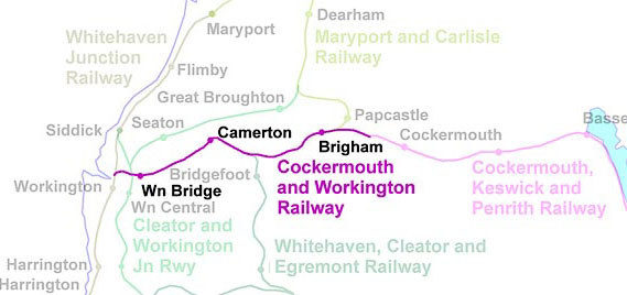 RWY024.jpg |
||
|
|
|||
 BLW38.jpg (taken 18.4.2006) |
|||
|
|
|||
| evidence:- | old map:- OS County Series (Cmd 54 1) placename:- Cockermouth and Workington Railway |
||
| source data:- | Maps, County Series maps of Great Britain, scales 6 and 25
inches to 1 mile, published by the Ordnance Survey, Southampton,
Hampshire, from about 1863 to 1948. "COCKERMOUTH &WORKINGTON RAILWAY" |
||
|
|
|||
| evidence:- | old map:- Garnett 1850s-60s H |
||
| source data:- | Map of the English Lakes, in Cumberland, Westmorland and
Lancashire, scale about 3.5 miles to 1 inch, published by John
Garnett, Windermere, Westmorland, 1850s-60s.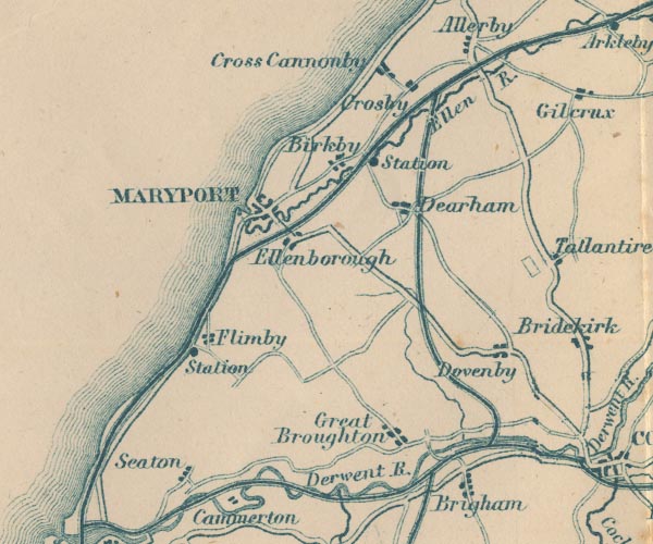 GAR2NY03.jpg triple line, light bold light, railway 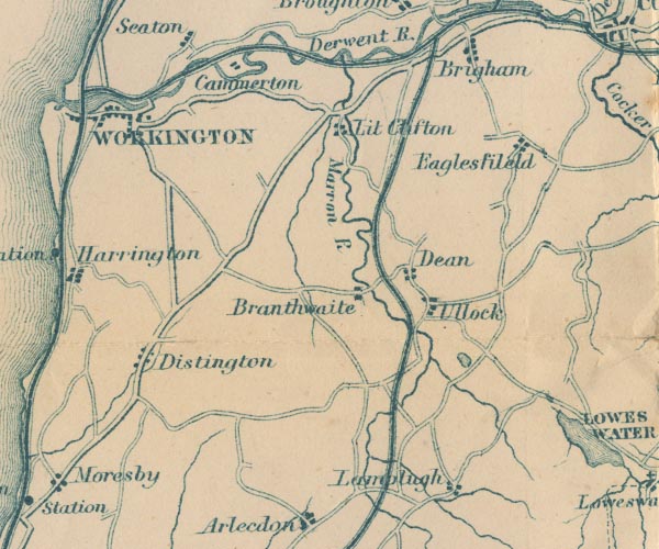 GAR2NY02.jpg item:- JandMN : 82.1 Image © see bottom of page |
||
|
|
|||
| evidence:- | old map:- LMS 1939 B |
||
| source data:- | 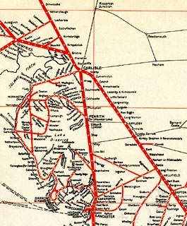 click to enlarge click to enlargeLMS6Cm.jpg "MAP OF LMS RAILWAY" item:- JandMN : 1016.5 Image © see bottom of page |
||
|
|
|||
| hearsay:- |
8¾miles. |
||
|
|
|||
| person:- | railway company : Cockermouth and Workington Railway |
||
| date:- | 1845 to 1866 |
||
|
|
|||
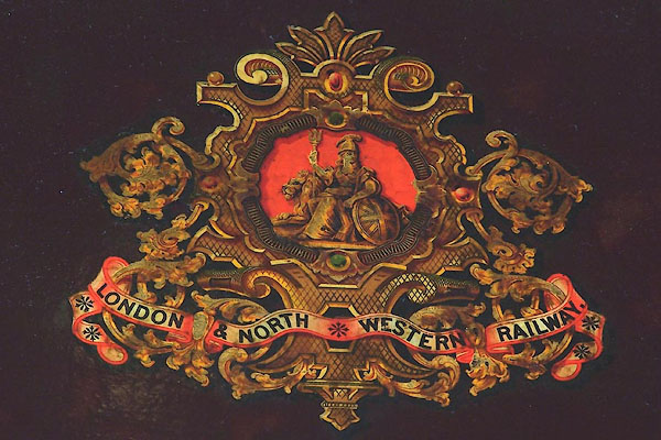
| person:- | railway company : London and North Western Railway; LNWR |
||
| date:- | 1866 to 1923 |
||
|
|
|||
| person:- | railway company : London, Midland and Scottish Railway; LMS |
||
| date:- | 1923 to 1948 |
||
|
|
|||
| person:- | railway company : British Railways; BR |
||
| date:- | 1948 |
||
|
|
|||
| goes through:- |  Cockermouth Station, Cockermouth (2) Cockermouth Goods Junction, Brigham Brigham Station, Brigham Broughton Cross Goods Depot, Brigham Marron Junction, Little Clifton railway viaduct, Camerton Camerton Station, Camerton Miser's Bridge, Camerton Workington Bridge Junction, Workington Workington Bridge Station, Workington railway bridge, Workington (3) railway junction, Workington (2) Derwent Junction, Workington Cockermouth Station, Cockermouth (2) Cockermouth Goods Junction, Brigham Brigham Station, Brigham Broughton Cross Goods Depot, Brigham Marron Junction, Little Clifton railway viaduct, Camerton Camerton Station, Camerton Miser's Bridge, Camerton Workington Bridge Junction, Workington Workington Bridge Station, Workington railway bridge, Workington (3) railway junction, Workington (2) Derwent Junction, Workington21.7.1845: authorized - 1847: opened - |
||
|
|
|||
| mapping:- | railway junction, Workington (2) 1864: open - 1953: closed - |
||
|
|
|||
Lakes Guides menu.