 Jansson 1646 NY66


|

|
|
|
gazetteer links places may or may not be labelled on the map |
||

|
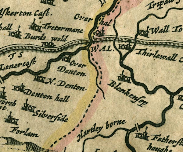
-- Birdoswald -- "Burds wold" |
|
|
|
-- Blenkinsopp Hall -- "Blenkensop" |
|
|
|
-- bridge, Bridge End |
|
|
|
-- Featherstone -- "Fetherston haughe" |
|
|
|
-- Hadrian's Wall -- "THE PICTS WAL." -- "THE
PICTS WAL." |
|
|
|
-- Hartley Burn -- "Hartley borne" |
|
|
|
-- Irthing, River -- "Ireingh fl." |
|
|
|
-- Nether Denton -- "N. Denton" |
|
|
|
-- Over Hall (?) -- "Overhal" |
|
|
|
-- Poltross Burn |
|
|
|
-- Pow Charney Burn |
|
|
|
-- Silver Side -- "Silverside" |
|
|
|
-- Thirlwall Castle -- "Thirlewall Cast." |
|
|
|
-- Triermain -- "Tretermane" |
|
|
|
-- Upper Denton -- "Over Denton" |
|
|
|
-- Walltown -- "Wall towne" |
|
|
civil parishes The area roughly includes parts of parishes:- Kingwater Midgeholme Nether Denton Waterhead Farlam Upper Denton |
||
|
|
||
|
|
Lakes Guides menu. | |