 Jansson 1646 NY44


|

|
|
|
gazetteer links places may or may not be labelled on the map |
||

|
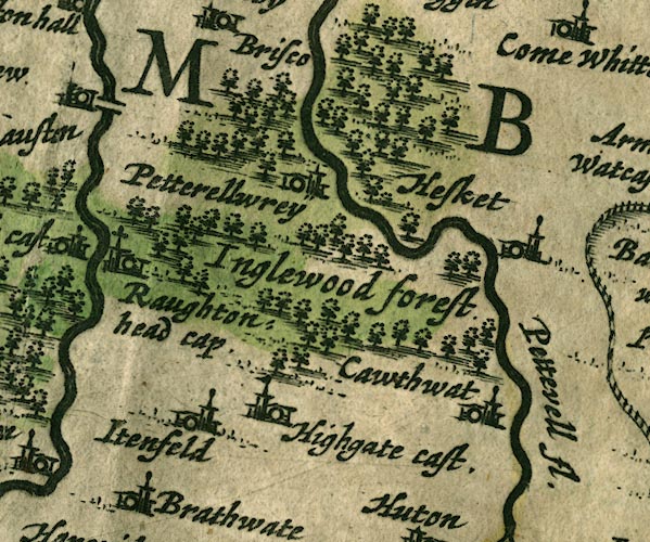
-- Calthwaite -- "Cawthwat" |
|
|
|
-- High Head Castle -- "Highgate cast." |
|
|
|
-- High Hesket -- "Hesket" |
|
|
|
-- Inglewood Forest -- "Inglewood forest" |
|
|
|
-- Itonfield -- "Itenfeld" |
|
|
|
-- Petteril, River -- "Pettevell fl." |
|
|
|
-- Raughton Head -- "Raughtonhead cap" |
|
|
|
-- Wreay -- "Petterellwrey" |
|
|
civil parishes The area roughly includes parts of parishes:- Lazonby Hesket Cumwhitton Dalston Castle Sowerby St Cuthbert Without Wetheral Skelton |
||
|
|
||
|
|
Lakes Guides menu. | |