 Garnett 1850s-60s SD69


|

|
|
|
gazetteer links places may or may not be labelled on the map |
||

|
-- Dee, River |
|
|
|
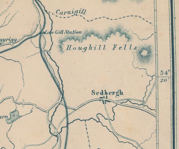
-- Howgill Fells -- "Houghill Fells" |
|
|
|
-- Lancaster and Carlisle Railway -- "Lancaster & Carlisle
Railway" -- "Lancaster & Carlisle Railway" |
|
|
|
-- Low Gill and Ingleton branch railway (?) |
|
|
|
-- Low Gill Station -- "Low Gill Station" |
|
|
|
-- Lune, River -- "R. Lune" -- "R. Lune" --
"R. Lune" |
|
|
|
-- Rawthey, River |
|
|
|
-- Sedbergh -- "Sedbergh" |
|
|
civil parishes The area roughly includes parts of parishes:- Orton S Grayrigg Killington Firbank Lambrigg Middleton Tebay Dent Ravenstonedale Garsdale Sedbergh |
||
|
|
||
|
|
Lakes Guides menu. | |