 Old Cumbria Gazetteer
 |
 |
|
| Howgill Fells, Howgill | ||
| Howgill Fells | ||
| civil parish:- | Orton S (formerly Westmorland) | |
| civil parish:- | Ravenstonedale (formerly Westmorland) | |
| county:- | Cumbria | |
| locality type:- | hill | |
| 1Km square:- | SD6699 (and lots more) | |
| 10Km square:- | SD69 | |
|
|
||
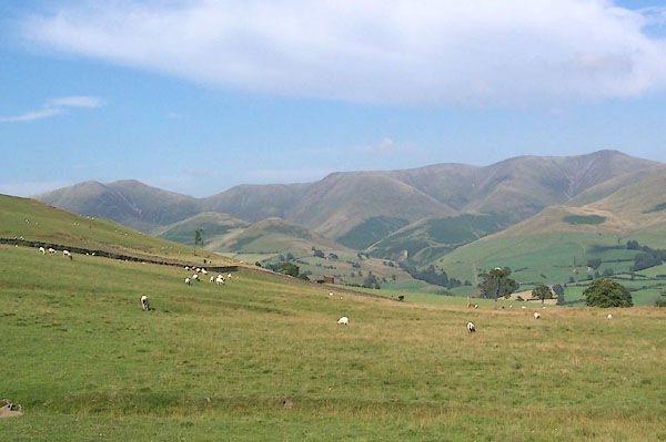 BMK79.jpg (taken 21.7.2006) 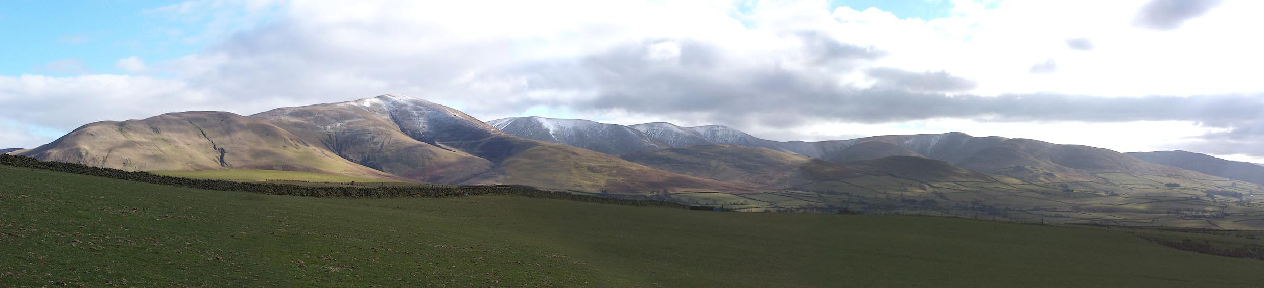 Click to enlarge BLQ30.jpg From the W. (taken 25.2.2006) |
||
|
|
||
| evidence:- | old map:- Bowen and Kitchin 1760 |
|
| source data:- | Map, hand coloured engraving, A New Map of the Counties of
Cumberland and Westmoreland Divided into their Respective Wards,
scale about 4 miles to 1 inch, by Emanuel Bowen and Thomas
Kitchin et al, published by T Bowles, Robert Sayer, and John
Bowles, London, 1760.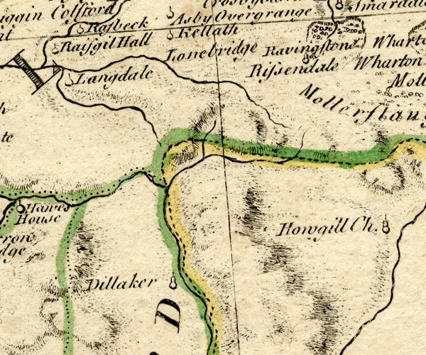 BO18NY60.jpg hill hachuring item:- Armitt Library : 2008.14.10 Image © see bottom of page |
|
|
|
||
| evidence:- | old map:- Jefferys 1770 (Wmd) placename:- Hougill Fells |
|
| source data:- | Map, 4 sheets, The County of Westmoreland, scale 1 inch to 1
mile, surveyed 1768, and engraved and published by Thomas
Jefferys, London, 1770.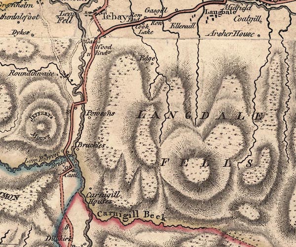 J5NY60SW.jpg 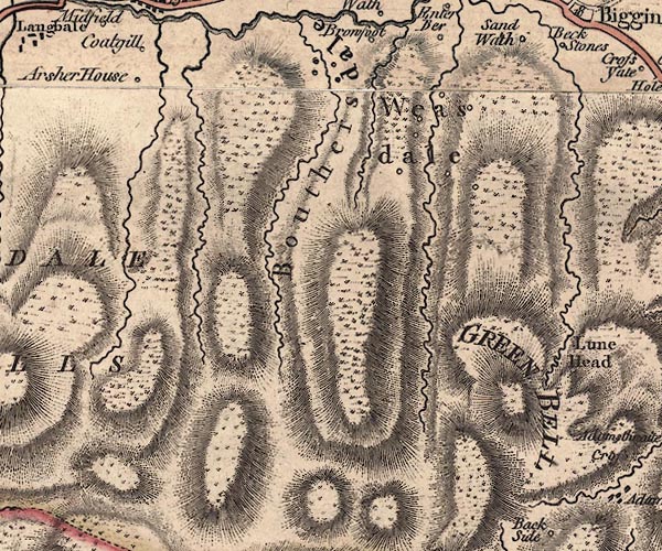 J5NY60SE.jpg 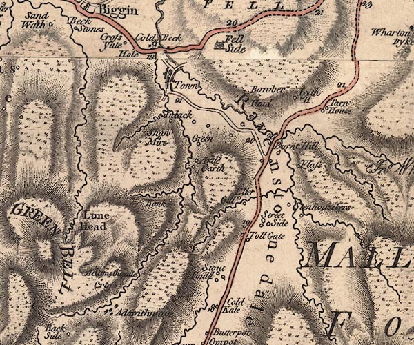 J5NY70SW.jpg 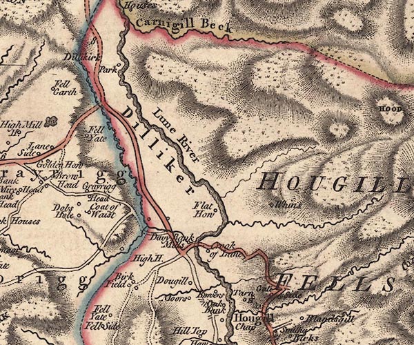 J5SD69NW.jpg 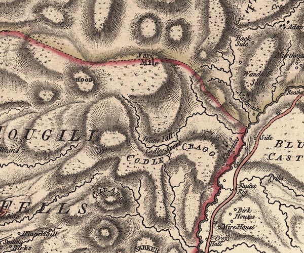 J5SD69NE.jpg "HOUGILL FELLS" hill hachuring; hill or mountain item:- National Library of Scotland : EME.s.47 Images © National Library of Scotland |
|
|
|
||
| evidence:- | old map:- Cary 1789 (edn 1805) placename:- Hougill Fells |
|
| source data:- | Map, uncoloured engraving, Westmoreland, scale about 2.5 miles
to 1 inch, by John Cary, London, 1789; edition 1805.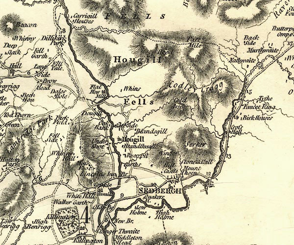 CY24SD69.jpg "Hougill Fells" hill hachuring item:- JandMN : 129 Image © see bottom of page |
|
|
|
||
| evidence:- | old map:- Garnett 1850s-60s H placename:- Houghill Fells |
|
| source data:- | Map of the English Lakes, in Cumberland, Westmorland and
Lancashire, scale about 3.5 miles to 1 inch, published by John
Garnett, Windermere, Westmorland, 1850s-60s.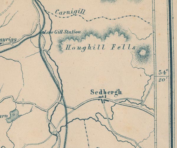 GAR2SD69.jpg "Houghill Fells" hill hachuring item:- JandMN : 82.1 Image © see bottom of page |
|
|
|
||
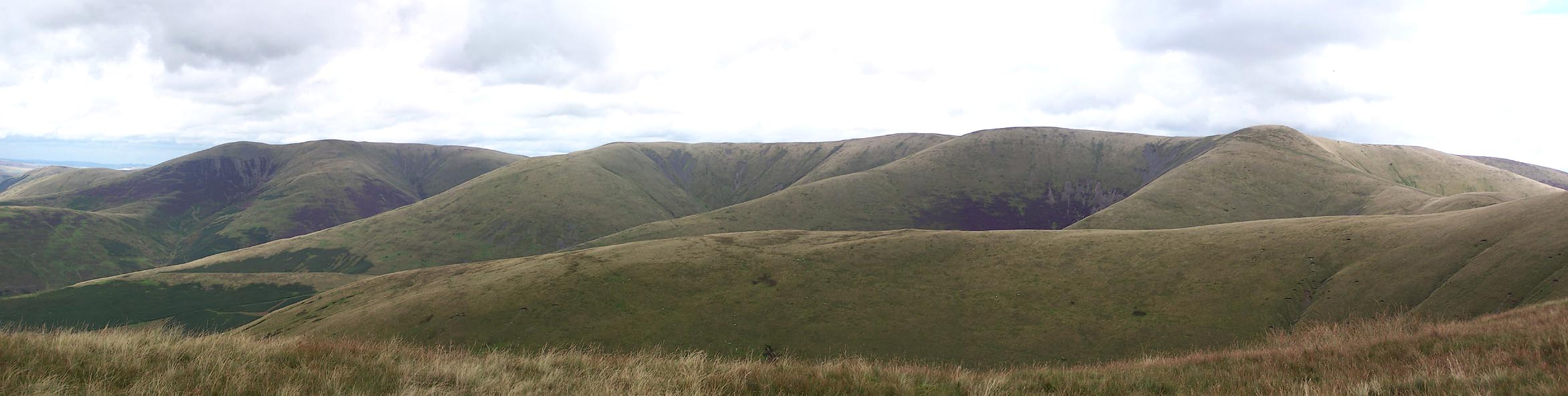 Click to enlarge BRI29.jpg From the SW. (taken 27.8.2009) 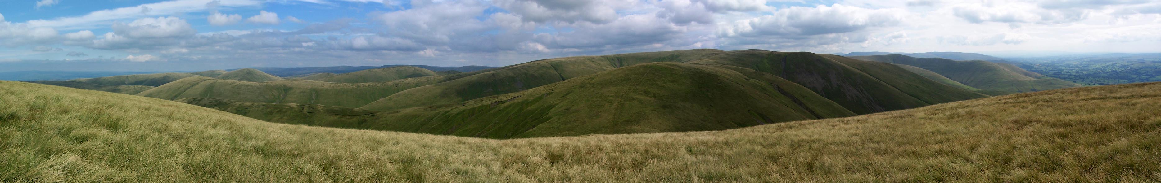 Click to enlarge BTJ30.jpg From Breaks Head, (taken 27.8.2009) 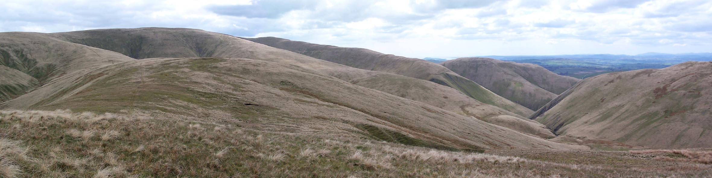 Click to enlarge BWJ66.jpg Central area from Docker Knott. (taken 5.5.2012) 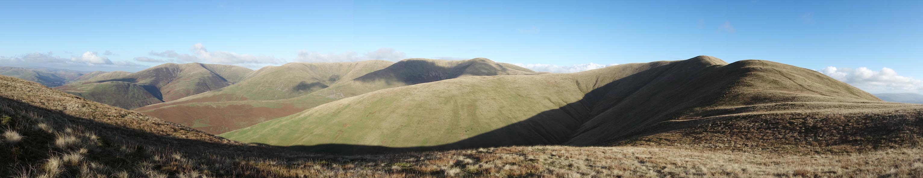 Click to enlarge CCA41.jpg Fell Top, Breaks Top, White Fell Head, Bram Rigg Top, Calders, Arant How, and Ben front centre. (taken 5.11.2014) 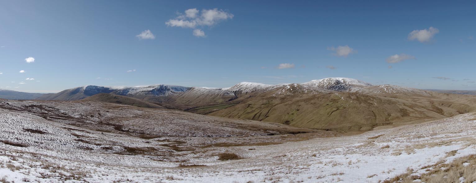 Click to enlarge CER35.jpg from E. (taken 7.3.2016) 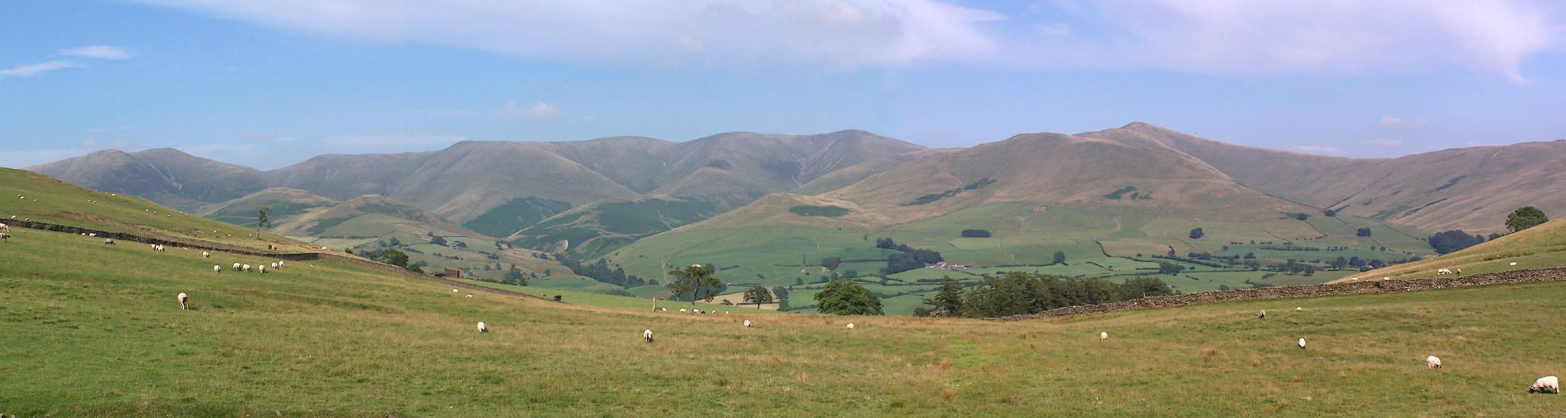 Click to enlarge BMK78.jpg (taken 21.7.2006) |
||
|
|
||
 Lakes Guides menu.