 Garnett 1850s-60s NY60


|

|
|
|
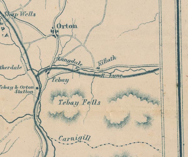
gazetteer links places may or may not be labelled on the map |
||

|
-- Carlin Gill -- "Carnigill" |
|
|
|
-- Kelleth -- "Killath" |
|
|
|
-- Lancaster and Carlisle Railway -- "Lancaster & Carlisle
Railway" -- "Lancaster & Carlisle Railway" |
|
|
|
-- Longdale -- "Langdale" |
|
|
|
-- Lune, River -- "R. Lune" -- "R. Lune" --
"R. Lune" |
|
|
|
-- Orton -- "Orton" |
|
|
|
-- South Durham and Lancashire Union Railway |
|
|
|
-- Tebay Fell -- "Tebay Fells" |
|
|
|
-- Tebay Station -- "Tebay & Orton Station" |
|
|
|
-- Tebay -- "Tebay" |
|
|
civil parishes The area roughly includes parts of parishes:- Tebay Grayrigg Crosby Ravensworth Orton S Ravenstonedale Asby Crosby Garrett |
||
|
|
||
|
|
Lakes Guides menu. | |