 Old Cumbria Gazetteer
 |
 |
|
| Carlin Gill | ||
| runs into:- |  Lune, River Lune, River |
|
|
|
||
| locality:- | Howgill Fells | |
| civil parish:- | Tebay (formerly Westmorland) | |
| civil parish:- | Sedbergh (formerly Yorkshire) | |
| county:- | Cumbria | |
| locality type:- | river | |
| locality type:- | valley | |
| locality type:- | boundary | |
| locality type:- | parish boundary | |
| locality type:- | county boundary (once) | |
| 1Km square:- | SD6399 (etc) | |
| 10Km square:- | SD69 | |
|
|
||
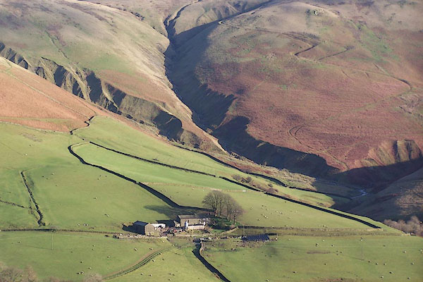 BNB81.jpg (taken 8.12.2006) 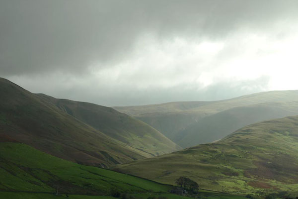 BTR48.jpg (taken 16.10.2010) |
||
|
|
||
| evidence:- | old map:- Cary 1789 (edn 1805) |
|
| source data:- | Map, uncoloured engraving, Westmoreland, scale about 2.5 miles
to 1 inch, by John Cary, London, 1789; edition 1805.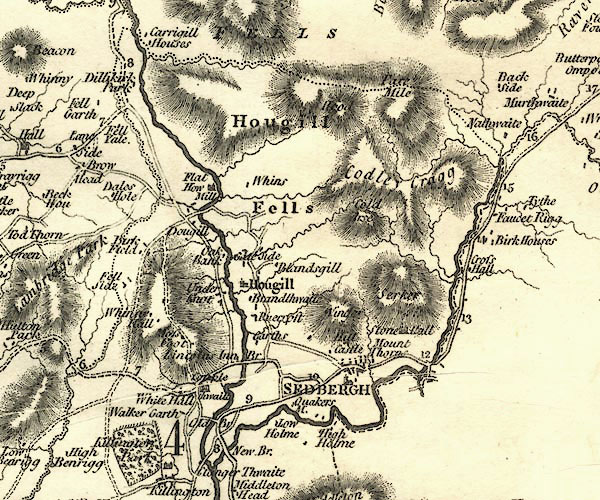 CY24SD69.jpg river; shown as a ward boundary, should be the county boundary item:- JandMN : 129 Image © see bottom of page |
|
|
|
||
| evidence:- | old map:- Aikin 1790 (Wmd) placename:- |
|
| source data:- | Map, uncoloured engraving, Westmoreland ie Westmorland, scale
about 8.5 miles to 1 inch, by John Aikin, London, 1790.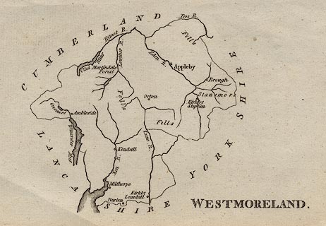 click to enlarge click to enlargeAIK2.jpg "" river; on county boundary item:- JandMN : 51 Image © see bottom of page |
|
|
|
||
| evidence:- | old map:- Garnett 1850s-60s H placename:- Carnigill |
|
| source data:- | Map of the English Lakes, in Cumberland, Westmorland and
Lancashire, scale about 3.5 miles to 1 inch, published by John
Garnett, Windermere, Westmorland, 1850s-60s.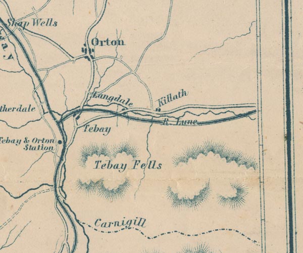 GAR2NY60.jpg "Carnigill" labelled beside the county boundary item:- JandMN : 82.1 Image © see bottom of page |
|
|
|
||
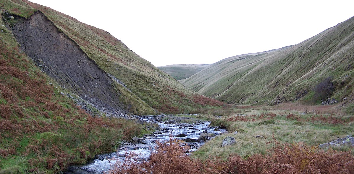 Click to enlarge BPT94.jpg (taken 27.10.2008) 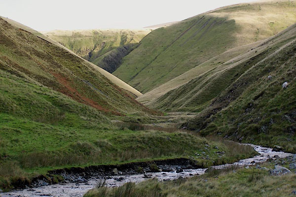 BPT95.jpg (taken 27.10.2008) 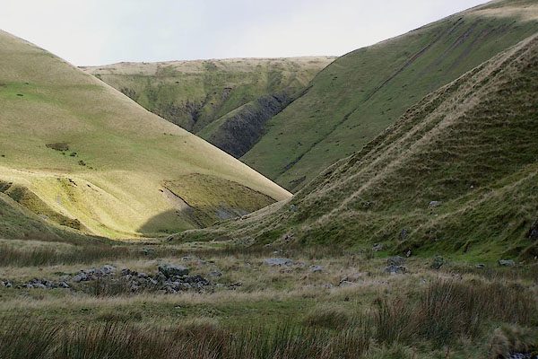 BPT96.jpg (taken 27.10.2008) 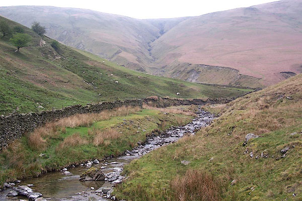 BNP40.jpg At Low Carlingill Bridge. (taken 18.4.2007) 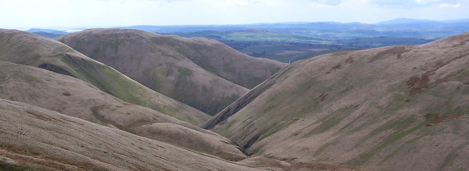 Click to enlarge BWJ65.jpg From above. (taken 5.5.2012) 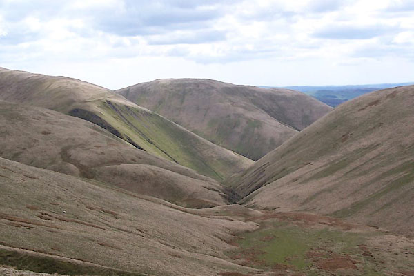 BWJ67.jpg and Blakethwaite Bottom (taken 5.5.2012) |
||
|
|
||
Lakes Guides menu.