 Garnett 1850s-60s NY55


|

|
|
|
gazetteer links places may or may not be labelled on the map |
||

|
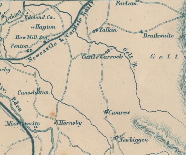
-- Castle Carrock -- "Castle Carrock" |
|
|
|
-- Croglin Water -- "Croglin W." |
|
|
|
-- Cumrew -- "Cumrew" |
|
|
|
-- Cumwhitton -- "Cumwhitton" |
|
|
|
-- Farlam -- "Farlam" |
|
|
|
-- Forest Head -- "Brathwaite" |
|
|
|
-- Gelt, River -- "Gelt R." |
|
|
|
-- Hayton -- "Hayton" |
|
|
|
-- Hornsby -- "Hornsby" |
|
|
|
-- How Mill Station -- "How Mill Sta." |
|
|
|
-- Moorthwaite -- "Moorthwaite" |
|
|
|
-- Newbiggin -- "Newbiggen" |
|
|
|
-- Newcastle and Carlisle Railway -- "Newcastle & Carlisle
Raily." |
|
|
|
-- Talkin -- "Talkin" |
|
|
civil parishes The area roughly includes parts of parishes:- Castle Carrock Cumrew Midgeholme Cumwhitton Geltsdale Carlatton Hayton Brampton Ainstable Farlam |
||
|
|
||
|
|
Lakes Guides menu. | |