 Old Cumbria Gazetteer
 |
 |
|
| How Mill Station, How | ||
| gone | ||
| How Mill Station | ||
| site name:- | Newcastle and Carlisle Railway | |
| locality:- | How Mill | |
| locality:- | How | |
| civil parish:- | Hayton (formerly Cumberland) | |
| county:- | Cumbria | |
| locality type:- | railway station (gone) | |
| coordinates:- | NY50995654 | |
| 1Km square:- | NY5056 | |
| 10Km square:- | NY55 | |
| SummaryText:- | Opened about 1838; closed 1959. | |
|
|
||
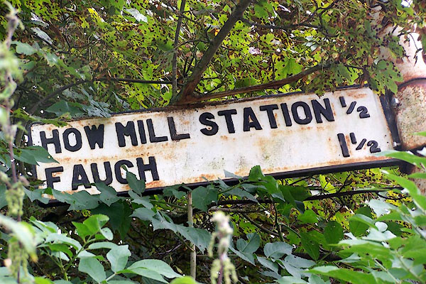 BOD66.jpg Fingerpost, half a mile away. (taken 7.9.2007) |
||
|
|
||
| evidence:- | old map:- OS County Series (Cmd 24 4) placename:- How Mill Station item:- railway signal; railway milepost |
|
| source data:- | Maps, County Series maps of Great Britain, scales 6 and 25
inches to 1 mile, published by the Ordnance Survey, Southampton,
Hampshire, from about 1863 to 1948.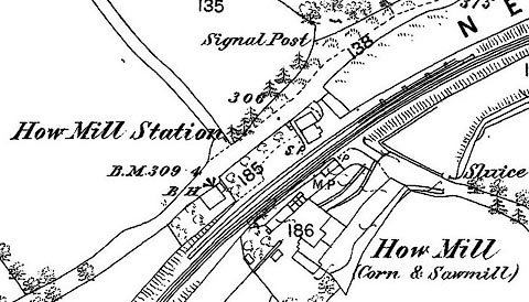 click to enlarge click to enlargeCSRY0011.jpg "How Mill Station / S.P. / M.P." |
|
|
|
||
| evidence:- | old map:- Garnett 1850s-60s H placename:- How Mill Station |
|
| source data:- | Map of the English Lakes, in Cumberland, Westmorland and
Lancashire, scale about 3.5 miles to 1 inch, published by John
Garnett, Windermere, Westmorland, 1850s-60s.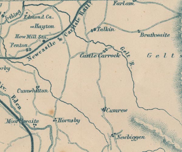 GAR2NY55.jpg "How Mill Sta." dot by railway item:- JandMN : 82.1 Image © see bottom of page |
|
|
|
||
| evidence:- | probably old map:- Post Office 1850s-1900s placename:- How Mill |
|
| source data:- | Post road maps, General Post Office Circulation Map for England
and Wales, for the General Post Office, London, 1850s-1900s. click to enlarge click to enlargePOF7Cm.jpg "How Mill" map date 1909 |
|
|
|
||
| evidence:- | old map:- Post Office 1850s-1900s placename:- How Mill Station |
|
| source data:- | Post road maps, General Post Office Circulation Map for England
and Wales, for the General Post Office, London, 1850s-1900s. click to enlarge click to enlargePF10Cm.jpg "How Mill Sta." map date 1892 |
|
|
|
||
| :- |
images courtesy of the British Postal Museum and Hampshire CC Museums |
|
|
|
||
 Lakes Guides menu.