 Garnett 1850s-60s NY14


|

|
|
|
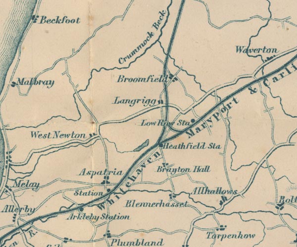
gazetteer links places may or may not be labelled on the map |
||

|
-- Allhallows -- "Allhallows" |
|
|
|
-- Aspatria Station -- "Sta" |
|
|
|
-- Aspatria -- "Aspatria" |
|
|
|
-- Blennerhasset -- "Blennerhasset" |
|
|
|
-- Brayton Park -- "Brayton Hall" |
|
|
|
-- Bromfield -- "Broomfield" |
|
|
|
-- Crummock Beck -- "Crummock Beck" |
|
|
|
-- Holme Dub -- "Crummock Beck" |
|
|
|
-- Langrigg -- "Langrigg" |
|
|
|
-- Low Row Station -- "Low Row Sta" |
|
|
|
-- Maryport and Carlisle Railway -- "Whitehaven Maryport &
Carlisle Railway" |
|
|
|
-- Solway Junction Railway |
|
|
|
-- Westnewton -- "West Newton" |
|
|
civil parishes The area roughly includes parts of parishes:- Blennerhasset and Torpenhow Allonby Bromfield Westnewton Hayton and Mealo Boltons Holme Abbey Holme Low Dundraw Bothel and Threapland Holme St Cuthbert Oughterside and Allerby Plumbland Aspatria Allhallows |
||
|
|
||
|
|
Lakes Guides menu. | |