 Old Cumbria Gazetteer
 |
 |
|
| Low Row Station, Low Row | ||
| Low Row Station | ||
| site name:- | Newcastle and Carlisle Railway | |
| locality:- | Low Row | |
| civil parish:- | Nether Denton (formerly Cumberland) | |
| county:- | Cumbria | |
| locality type:- | railway station | |
| coordinates:- | NY58506307 | |
| 1Km square:- | NY5863 | |
| 10Km square:- | NY56 | |
| SummaryText:- | Opened about 1838; closed 1959. | |
|
|
||
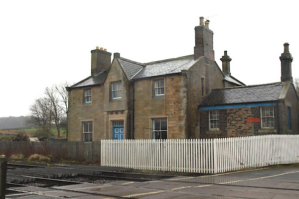 BOY86.jpg Old station house? (taken 4.4.2008) |
||
|
|
||
| evidence:- | old map:- OS County Series (Cmd 18 3) item:- railway signal; railway milepost |
|
| source data:- | Maps, County Series maps of Great Britain, scales 6 and 25
inches to 1 mile, published by the Ordnance Survey, Southampton,
Hampshire, from about 1863 to 1948.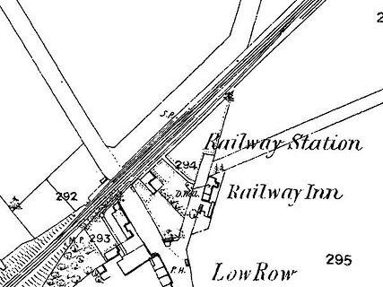 click to enlarge click to enlargeCSRY0005.jpg "Railway Station / M.P. / S.P. / Railway Inn" at Low Row |
|
|
|
||
| evidence:- | old map:- Garnett 1850s-60s H placename:- Low Row Station |
|
| source data:- | Map of the English Lakes, in Cumberland, Westmorland and
Lancashire, scale about 3.5 miles to 1 inch, published by John
Garnett, Windermere, Westmorland, 1850s-60s.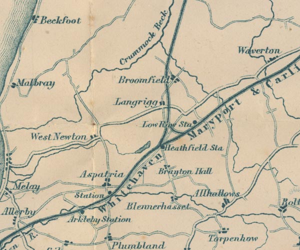 GAR2NY14.jpg "Low Row Sta" dot by railway item:- JandMN : 82.1 Image © see bottom of page |
|
|
|
||
 Post Office maps Post Office maps |
||
|
|
||
 Lakes Guides menu.