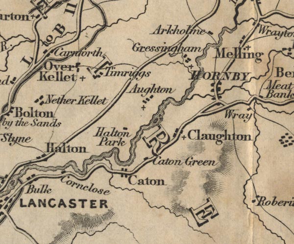
 Ford 1839 map SD56


|

|
|
|
gazetteer links places may or may not be labelled on the map |
||

|
-- Arkholme -- "Arkholme" |
|
|
|
-- Aughton -- "Aughton" |
|
|
|
-- Caton Green -- "Caton Green" |
|
|
|
-- Caton -- "Caton" |
|
|
|
-- Claughton -- "Claughton" |
|
|
|
-- Corn Close -- "Cornclose" |
|
|
|
-- Gressingham -- "Gressingham" |
|
|
|
-- Halton Park -- "Halton Park" |
|
|
|
-- Hornby -- "HORNBY" |
|
|
|
-- Lancaster Canal |
|
|
|
-- Melling -- "Melling" |
|
|
|
-- Over Kellett -- "Over Kellet" |
|
|
|
-- Lancaster to Kendal -- "B to K 11 Ms." -- "L to
B 11 Ms." |
|
|
counties The area includes parts of counties:- Lancashire |
||
|
|
||
|
|
Lakes Guides menu. | |