 Old Cumbria Gazetteer
 |
 |
|
| Claughton, Lancashire | ||
| Claughton | ||
| county:- | Lancashire | |
| locality type:- | buildings | |
| coordinates:- | SD566666 | |
| 1Km square:- | SD5666 | |
| 10Km square:- | SD56 | |
|
|
||
| evidence:- | old map:- Ford 1839 map placename:- Claughton |
|
| source data:- | Map, uncoloured engraving, Map of the Lake District of
Cumberland, Westmoreland and Lancashire, scale about 3.5 miles
to 1 inch, published by Charles Thurnam, Carlisle, and by R
Groombridge, 5 Paternoster Row, London, 3rd edn 1843.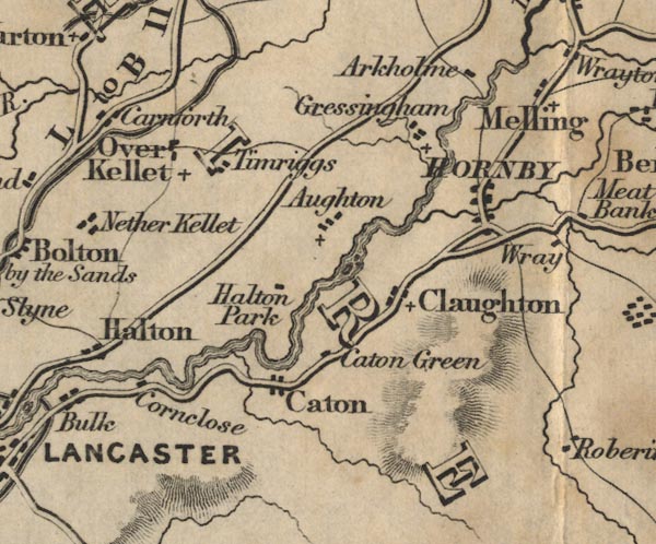 FD02SD56.jpg "Claughton" item:- JandMN : 100.1 Image © see bottom of page |
|
|
|
||
| evidence:- | old map:- Garnett 1850s-60s H placename:- Claughton |
|
| source data:- | Map of the English Lakes, in Cumberland, Westmorland and
Lancashire, scale about 3.5 miles to 1 inch, published by John
Garnett, Windermere, Westmorland, 1850s-60s.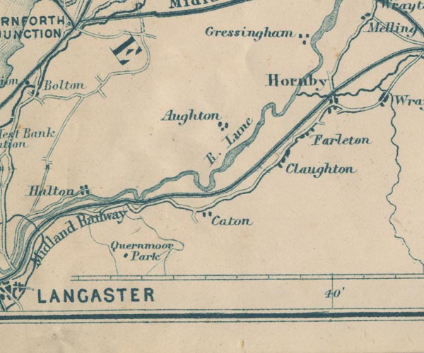 GAR2SD56.jpg "Claughton" blocks, settlement item:- JandMN : 82.1 Image © see bottom of page |
|
|
|
||
 Lakes Guides menu.