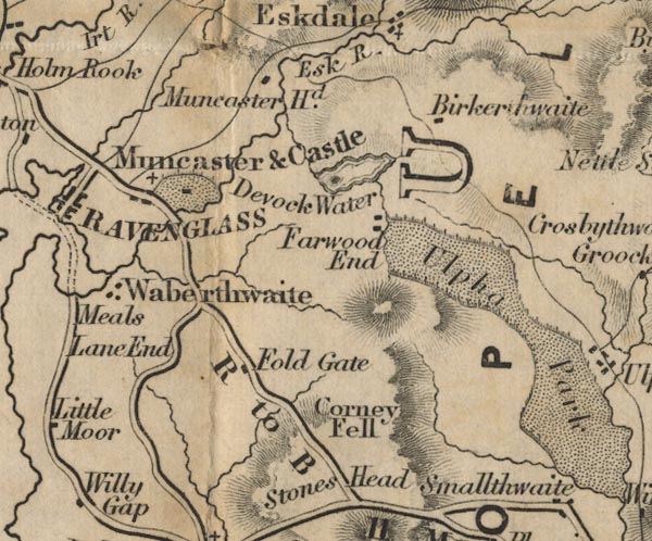
 Ford 1839 map SD19


|

|
|
|
gazetteer links places may or may not be labelled on the map |
||

|
-- Birkerthwaite -- "Birkerthwaite" |
|
|
|
-- Copeland -- "COPELAND" |
|
|
|
-- Corney Fell -- "Corney Fell" |
|
|
|
-- Devoke Water -- "Devock Water" |
|
|
|
-- Esk, River -- "Esk R." |
|
|
|
-- Fold Gate -- "Fold Gate" |
|
|
|
-- Hall Waberthwaite -- "Waberthwaite" |
|
|
|
-- Muncaster Castle -- "Muncaster & Castle" |
|
|
|
-- Muncaster Head -- "Muncaster Hd." |
|
|
|
-- Muncaster -- "Muncaster & Castle" |
|
|
|
-- Broughton to Ravenglass -- "R to B 11 Ms." |
|
|
|
-- Stoneside Hill -- "Stones Head" |
|
|
|
-- Ulpha Park -- "Ulpha Park" |
|
|
|
-- Woodend -- "Farwood End" |
|
|
civil parishes The area roughly includes parts of parishes:- Millom Without Bootle Ulpha Dunnerdale-with-Seathwaite Eskdale Irton with Santon Waberthwaite Muncaster |
||
|
|
||
|
|
Lakes Guides menu. | |