 Ford 1839 map NY62


|

|
|
|
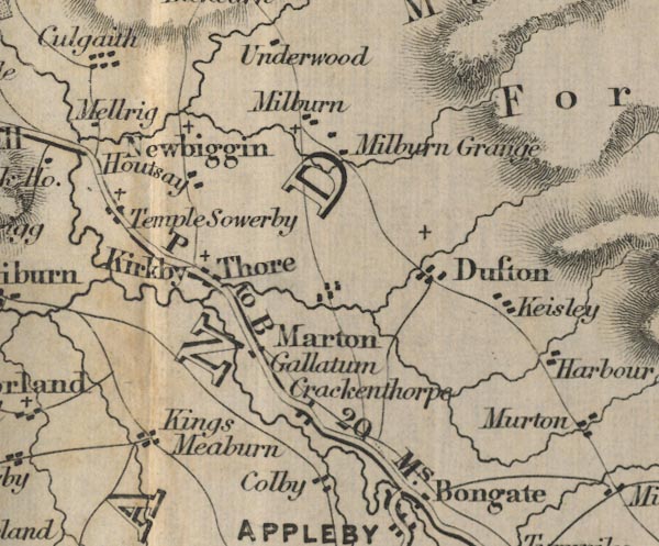
gazetteer links places may or may not be labelled on the map |
||

|
-- Colby -- "Colby" |
|
|
|
-- Crackenthorpe -- "Crackenthorpe" |
|
|
|
-- Dufton -- "Dufton" |
|
|
|
-- Houtsey -- "Houtsay" |
|
|
|
-- Keisley -- "Keisley" |
|
|
|
-- King's Meaburn -- "Kings Meaburn" |
|
|
|
-- Kirkby Thore -- "Kirkby Thore" |
|
|
|
-- Long Marton -- "Marton" |
|
|
|
-- Milburn Grange -- "Milburn Grange" |
|
|
|
-- Milburn -- "Milburn" |
|
|
|
-- Newbiggin -- "Newbiggin" |
|
|
|
-- Appleby to Penrith -- "P to B 20 Ms." |
|
|
|
-- Bravoniacum -- "Gallatum" |
|
|
|
-- Temple Sowerby -- "Temple Sowerby" |
|
|
civil parishes The area roughly includes parts of parishes:- Temple Sowerby Cliburn Crackenthorpe Bolton Newbiggin Long Marton Murton Crosby Ravensworth Brougham Dufton Sleagill Kirkby Thore Milburn Newby Culgaith King's Meaburn Morland Appleby-in-Westmorland Colby |
||
|
|
||
|
|
Lakes Guides menu. | |