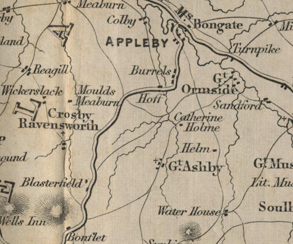
 Ford 1839 map NY61


|

|
|
|
gazetteer links places may or may not be labelled on the map |
||

|
-- Appleby-in-Westmorland -- "APPLEBY" |
|
|
|
-- Blasterfield Farm -- "Blasterfield" |
|
|
|
-- Bongate -- "Bongate" |
|
|
|
-- Catharine Holme -- "Catherine Holme" |
|
|
|
-- Crosby Ravensworth -- "Crosby Ravensworth" |
|
|
|
-- Great Asby -- "Gt. Ashby" |
|
|
|
-- Great Ormside -- "Gt. Ormside" |
|
|
|
-- Helm -- "Helm" |
|
|
|
-- Maulds Meaburn -- "Moulds Meaburn" |
|
|
|
-- Bowes to Appleby |
|
|
|
-- toll gate, Warcop -- "Turnpike" |
|
|
|
-- Water Houses -- "Water House" |
|
|
civil parishes The area roughly includes parts of parishes:- Crosby Ravensworth Hoff Orton S Asby Ormside Sleagill Colby King's Meaburn Appleby-in-Westmorland Murton |
||
|
|
||
|
|
Lakes Guides menu. | |