 Old Cumbria Gazetteer
 |
 |
|
| Toll Bar Cottage, Coupland | ||
| Toll Bar Cottage | ||
| site name:- | road, Brough to Appleby | |
| locality:- | Coupland | |
| civil parish:- | Warcop (formerly Westmorland) | |
| county:- | Cumbria | |
| locality type:- | buildings | |
| locality type:- | toll house (ex) | |
| locality type:- | toll gate (site) | |
| coordinates:- | NY71211876 | |
| 1Km square:- | NY7118 | |
| 10Km square:- | NY71 | |
|
|
||
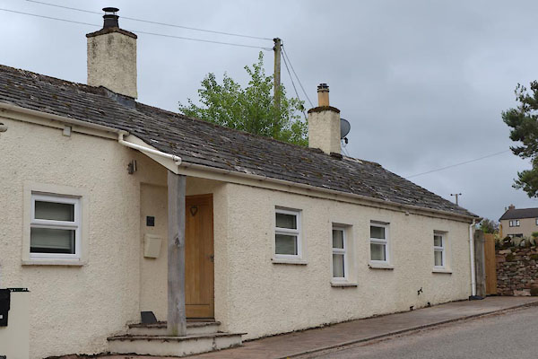 CGF20.jpg (taken 23.6.2017) |
||
|
|
||
| evidence:- | old map:- OS County Series (Wmd 15) |
|
| source data:- | Maps, County Series maps of Great Britain, scales 6 and 25
inches to 1 mile, published by the Ordnance Survey, Southampton,
Hampshire, from about 1863 to 1948. "T.P." |
|
|
|
||
| evidence:- | old map:- Ford 1839 map |
|
| source data:- | Map, uncoloured engraving, Map of the Lake District of
Cumberland, Westmoreland and Lancashire, scale about 3.5 miles
to 1 inch, published by Charles Thurnam, Carlisle, and by R
Groombridge, 5 Paternoster Row, London, 3rd edn 1843.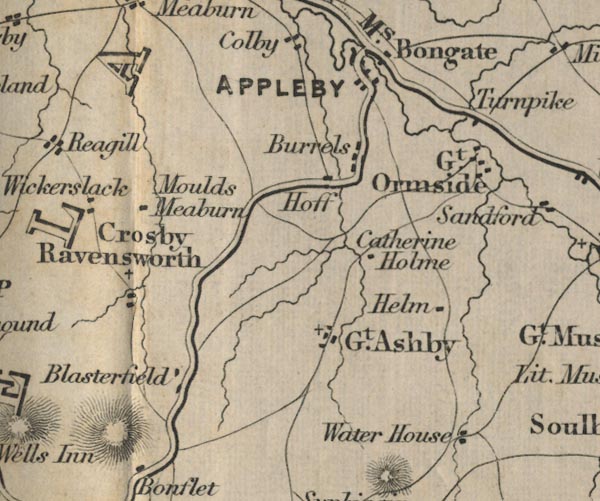 FD02NY61.jpg "Turnpike" By the road to Brough. item:- JandMN : 100.1 Image © see bottom of page |
|
|
|
||
 Lakes Guides menu.