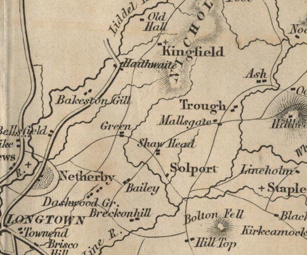
 Ford 1839 map NY47


|

|
|
|
gazetteer links places may or may not be labelled on the map |
||

|
-- Baileytown -- "Bailey" |
|
|
|
-- Baxton Gill, Nicholforest |
|
|
|
-- Bolton Fell -- "Bolton Fell" |
|
|
|
-- Brackenhill Tower -- "Breckonhill" |
|
|
|
-- Dashwellgreen -- "Dashwood Gr." |
|
|
|
-- Green -- "Green" |
|
|
|
-- Haithwaite -- "Haithwaite" |
|
|
|
-- Kingfield -- "Kingfield" |
|
|
|
-- Mallsgate -- "Mallsgate" |
|
|
|
-- Shawhead -- "Shaw Head" |
|
|
|
-- Solport -- "Solport" |
|
|
|
-- Trough -- "Trough" |
|
|
civil parishes The area roughly includes parts of parishes:- Hethersgill Solport Bewcastle Stapleton Kirkandrews Arthuret Nicholforest |
||
|
|
||
|
|
Lakes Guides menu. | |