 Old Cumbria Gazetteer
 |
 |
|
| Bolton Fell, Hethersgill | ||
| Bolton Fell | ||
| civil parish:- | Hethersgill (formerly Cumberland) | |
| civil parish:- | Stapleton (formerly Cumberland) | |
| county:- | Cumbria | |
| locality type:- | hill | |
| locality type:- | fell | |
| locality type:- | peat moss | |
| coordinates:- | NY48986891 (etc) | |
| 1Km square:- | NY4868 | |
| 10Km square:- | NY46 | |
|
|
||
| evidence:- | old map:- OS County Series (Cmd 11 3) placename:- Bolton Fell |
|
| source data:- | Maps, County Series maps of Great Britain, scales 6 and 25
inches to 1 mile, published by the Ordnance Survey, Southampton,
Hampshire, from about 1863 to 1948. |
|
|
|
||
| evidence:- | old map:- Donald 1774 (Cmd) placename:- Bolton Fell |
|
| source data:- | Map, hand coloured engraving, 3x2 sheets, The County of Cumberland, scale about 1
inch to 1 mile, by Thomas Donald, engraved and published by Joseph Hodskinson, 29
Arundel Street, Strand, London, 1774.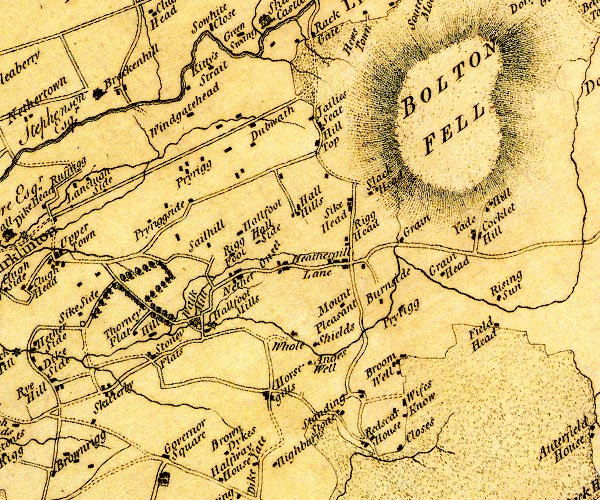 D4NY46NE.jpg "BOLTON FELL" hill hachuring; a hill or mountain item:- Carlisle Library : Map 2 Image © Carlisle Library |
|
|
|
||
| evidence:- | old map:- Cooper 1808 placename:- Bolton Fell |
|
| source data:- | Map, uncoloured engraving, Cumberland, scale about 10.5 miles to
1 inch, drawn and engraved by Cooper, published by R Phillips,
Bridge Street, Blackfriars, London, 1808. click to enlarge click to enlargeCOP3.jpg "Bolton Fell" hill hachuring; mountain or hill item:- JandMN : 86 Image © see bottom of page |
|
|
|
||
| evidence:- | old map:- Ford 1839 map placename:- Bolton Fell |
|
| source data:- | Map, uncoloured engraving, Map of the Lake District of
Cumberland, Westmoreland and Lancashire, scale about 3.5 miles
to 1 inch, published by Charles Thurnam, Carlisle, and by R
Groombridge, 5 Paternoster Row, London, 3rd edn 1843.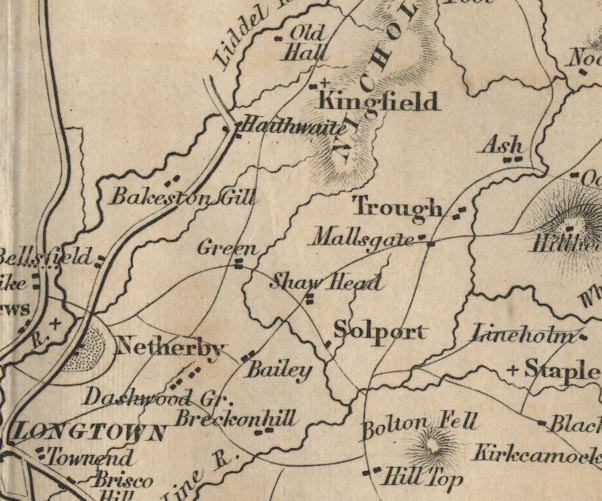 FD02NY47.jpg "Bolton Fell" Hill hachuring. item:- JandMN : 100.1 Image © see bottom of page |
|
|
|
||
 Lakes Guides menu.