 Old Cumbria Gazetteer
 |
 |
|
| Kingfield, Nicholforest | ||
| Kingfield | ||
| civil parish:- | Nicholforest (formerly Cumberland) | |
| county:- | Cumbria | |
| locality type:- | locality | |
| coordinates:- | NY45507788 (about, etc) | |
| 1Km square:- | NY4577 | |
| 10Km square:- | NY47 | |
|
|
||
| evidence:- | old map:- Ogilby 1675 (plate 62) placename:- Kings Field |
|
| source data:- | Raod strip map, uncoloured engraving, the Road from Carlisle to
Barwick, scale about 1 inch to 1 mile, by John Ogilby, London,
1675.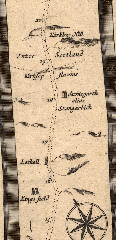 OG62m015.jpg In mile 15, Cumberland. "Kings field" houses off the left of the road. item:- JandMN : 83 Image © see bottom of page |
|
|
|
||
| evidence:- | old map:- Morden 1695 (Cmd) placename:- Kings Field |
|
| source data:- | Map, uncoloured engraving, Cumberland, scale about 4 miles to 1
inch, by Robert Morden, 1695, published by Abel Swale, the
Unicorn, St Paul's Churchyard, Awnsham, and John Churchill, the
Black Swan, Paternoster Row, London, 1695-1715.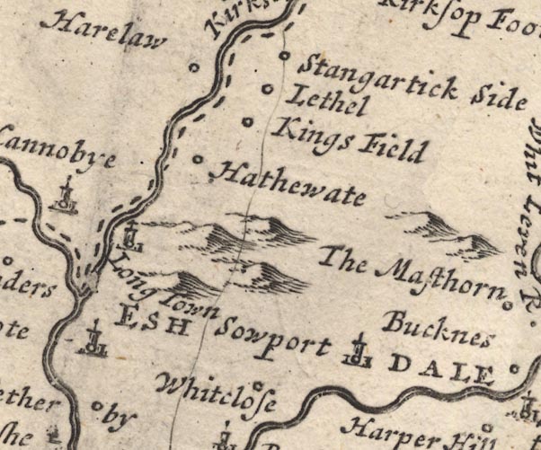 MD12NY47.jpg "Kings Field" Circle. item:- JandMN : 90 Image © see bottom of page |
|
|
|
||
| evidence:- | perhaps old map:- Bowen 1720 (plate 161) placename:- Kingsford |
|
| source data:- | Road strip map, uncoloured engraving, pl.161, part of The Road
from Carlisle to Barwick, scale about 2 miles to 1 inch, with
sections in Cumberland, and Scotland, published by Emanuel
Bowen, St Katherines, London, 1720.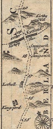 B161m15.jpg "Kingsford" Buildings west of road; mile 16. item:- JandMN : 65.161 Image © see bottom of page |
|
|
|
||
| evidence:- | old map:- Millward and Dickinson 1737 placename:- Kingsfield |
|
| source data:- | Road map, photocopy, diagram, A New and Correct Map of Roads of
England, probably published by T Millward and B Dickinson, Inigo
Jones's Head, Fleet Street, London, 1737. "Kingsfield" 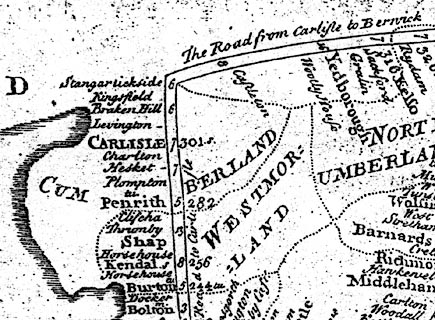 click to enlarge click to enlargeMWD1Cm.jpg item:- private collection : 264 Image © see bottom of page |
|
|
|
||
| evidence:- | old map:- Badeslade 1742 placename:- Kingsfield |
|
| source data:- | Map, uncoloured engraving, A Map of Cumberland North from
London, scale about 11 miles to 1 inch, with descriptive text,
by Thomas Badeslade, London, engraved and published by William
Henry Toms, Union Court, Holborn, London, 1742. click to enlarge click to enlargeBD10.jpg "Kingsfield" no symbol item:- JandMN : 115 Image © see bottom of page |
|
|
|
||
| evidence:- | old map:- Bowen and Kitchin 1760 placename:- Kingsford placename:- Kingsfield |
|
| source data:- | Map, hand coloured engraving, A New Map of the Counties of
Cumberland and Westmoreland Divided into their Respective Wards,
scale about 4 miles to 1 inch, by Emanuel Bowen and Thomas
Kitchin et al, published by T Bowles, Robert Sayer, and John
Bowles, London, 1760.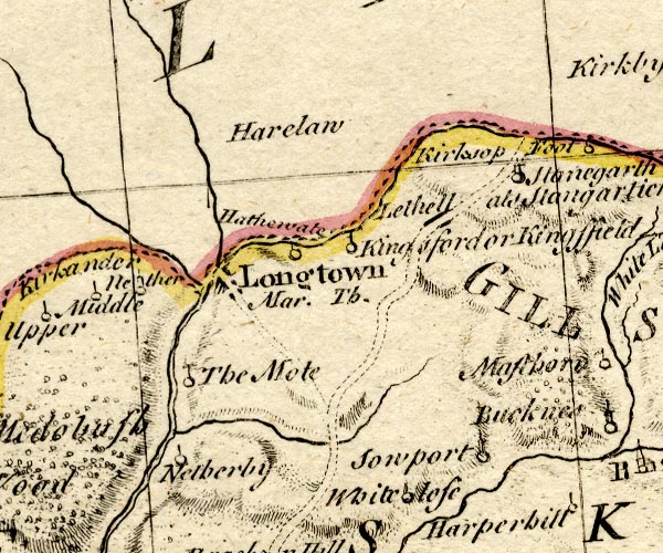 BO18NY47.jpg "Kingsford or Kingsfield" circle and half cross item:- Armitt Library : 2008.14.10 Image © see bottom of page |
|
|
|
||
| evidence:- | old map:- Donald 1774 (Cmd) placename:- Kingfield |
|
| source data:- | Map, hand coloured engraving, 3x2 sheets, The County of Cumberland, scale about 1
inch to 1 mile, by Thomas Donald, engraved and published by Joseph Hodskinson, 29
Arundel Street, Strand, London, 1774.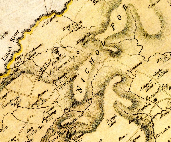 D4NY47NE.jpg "Kingfield / Milbourne Esq." house item:- Carlisle Library : Map 2 Image © Carlisle Library |
|
|
|
||
| evidence:- | old map:- Ford 1839 map placename:- Kingfield |
|
| source data:- | Map, uncoloured engraving, Map of the Lake District of
Cumberland, Westmoreland and Lancashire, scale about 3.5 miles
to 1 inch, published by Charles Thurnam, Carlisle, and by R
Groombridge, 5 Paternoster Row, London, 3rd edn 1843.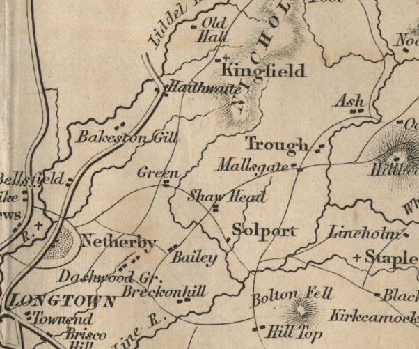 FD02NY47.jpg "Kingfield" item:- JandMN : 100.1 Image © see bottom of page |
|
|
|
||
 Lakes Guides menu.