 Ford 1839 map NY20


|

|
|
|
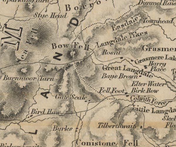
gazetteer links places may or may not be labelled on the map |
||

|
-- Base Brown -- "Bays Brown" |
|
|
|
-- Birdhow -- "Bird Haw" |
|
|
|
-- Birks -- "Byrks" |
|
|
|
-- Bow Fell -- "Bow Fell" |
|
|
|
-- Copeland -- "COPELAND" |
|
|
|
-- Easedale -- "Easdale" |
|
|
|
-- Fell Foot -- "Fell Foot" |
|
|
|
-- Gaitscale -- "Gate Scale" |
|
|
|
-- Great Langdale -- "Great Langdale" |
|
|
|
-- Harry Place Farm -- "Harry Place" |
|
|
|
-- High Birk Howe -- "Birk Row" |
|
|
|
-- Langdale Pikes -- "Langdale Pikes" |
|
|
|
-- Rossett -- "Ros[ ]it" |
|
|
|
-- Tilberthwaite -- "Tilberthwaite" |
|
|
civil parishes The area roughly includes parts of parishes:- Dunnerdale-with-Seathwaite Eskdale Lakes Ulpha Nether Wasdale Coniston St John's Castlerigg and Wythburn Borrowdale |
||
|
|
||
|
|
Lakes Guides menu. | |