 Old Cumbria Gazetteer
 |
 |
|
| Easedale, Lakes | ||
| Easedale | ||
| civil parish:- | Lakes (formerly Westmorland) | |
| county:- | Cumbria | |
| locality type:- | valley | |
| coordinates:- | NY32540835 (etc) | |
| 1Km square:- | NY3208 | |
| 10Km square:- | NY30 | |
|
|
||
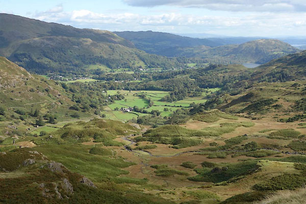 CBU33.jpg (taken 24.9.2014) |
||
|
|
||
| evidence:- | old map:- OS County Series (Wmd 18 16) placename:- Easedale |
|
| source data:- | Maps, County Series maps of Great Britain, scales 6 and 25
inches to 1 mile, published by the Ordnance Survey, Southampton,
Hampshire, from about 1863 to 1948. |
|
|
|
||
| evidence:- | old map:- Jefferys 1770 (Wmd) placename:- Easedale |
|
| source data:- | Map, 4 sheets, The County of Westmoreland, scale 1 inch to 1
mile, surveyed 1768, and engraved and published by Thomas
Jefferys, London, 1770.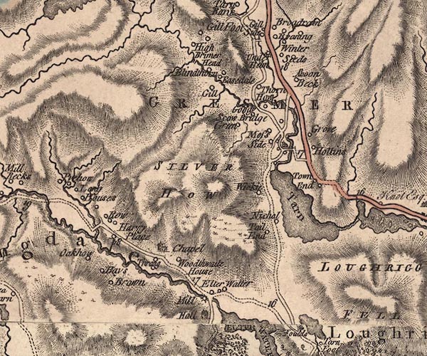 J5NY30NW.jpg "Easedale" circle, labelled in italic lowercase text; settlement, farm, house, or hamlet? item:- National Library of Scotland : EME.s.47 Image © National Library of Scotland |
|
|
|
||
| evidence:- | old print:- Green 1814 (plate 24) placename:- Easedale item:- cattle |
|
| source data:- | Print, tinted soft ground etching, Easedale from Butterlip How, Grasmere, Westmorland,
by William Green, Ambleside, Westmorland, 1814.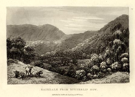 click to enlarge click to enlargeGN1024.jpg Plate 24 in Sixty Small Prints. printed at top right:- "24" printed at bottom:- "EASEDALE FROM BUTTERLIP HOW. / Published at Ambleside Augst. 1, 1814, by Wm. Green." item:- Armitt Library : A6653.24 Image © see bottom of page |
|
|
|
||
| evidence:- | old print:- Green 1814 (plate 24) placename:- Easedale item:- cattle |
|
| source data:- | Print, uncoloured soft ground etching, Easedale from Butterlip How, Grasmere, Westmorland,
by William Green, Ambleside, Westmorland, 1814.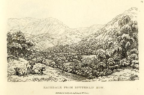 click to enlarge click to enlargeGN0924.jpg Plate 24 in Sixty Small Prints. printed at top right:- "24" printed at bottom:- "EASEDALE FROM BUTTERLIP HOW. / Published at Ambleside Augst. 1, 1814, by Wm. Green." item:- Armitt Library : A6656.24 Image © see bottom of page |
|
|
|
||
| evidence:- | old text:- Green 1814 placename:- Easedale |
|
| source data:- | Set of prints, soft ground etchings, Sixty Small Prints, with
text, A Description of a Series of Sixty Small Prints, by
William Green, Ambleside, Westmorland, 1814. goto source goto sourcepage 13:- "..." "Easedale is a romantic and secluded valley branching out of Grasmere; ..." |
|
|
|
||
| evidence:- | old map:- Otley 1818 placename:- Easdale |
|
| source data:- | Map, uncoloured engraving, The District of the Lakes,
Cumberland, Westmorland, and Lancashire, scale about 4 miles to
1 inch, by Jonathan Otley, 1818, engraved by J and G Menzies,
Edinburgh, Scotland, published by Jonathan Otley, Keswick,
Cumberland, et al, 1833.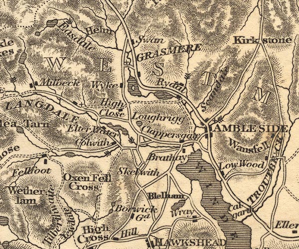 OT02NY30.jpg item:- JandMN : 48.1 Image © see bottom of page |
|
|
|
||
| evidence:- | descriptive text:- Ford 1839 (3rd edn 1843) placename:- Easedale |
|
| source data:- | Guide book, A Description of Scenery in the Lake District, by
Rev William Ford, published by Charles Thurnam, Carlisle, by W
Edwards, 12 Ave Maria Lane, Charles Tilt, Fleet Street, William
Smith, 113 Fleet Street, London, by Currie and Bowman,
Newcastle, by Bancks and Co, Manchester, by Oliver and Boyd,
Edinburgh, and by Sinclair, Dumfries, 1839. goto source Page 43:- "..." "EASEDALE." "Coldale Fell separates the Easedales. Passing" goto sourcePage 44:- "over Butterlip How, a little rocky and wooded hill north of the inn, proceed to Goody Bridge. Here the road rises into this quiet dale, and affords a glorious panorama of the surrounding vale, embracing the lake, church, and neighbouring dwellings, with Loughrigg behind. ... It will be pleasanter to return the same way back, than to pass forward, as may be done by pedestrians, either into Borrodale or Wythburn Head." |
|
|
|
||
| evidence:- | old map:- Ford 1839 map placename:- Easdale |
|
| source data:- | Map, uncoloured engraving, Map of the Lake District of
Cumberland, Westmoreland and Lancashire, scale about 3.5 miles
to 1 inch, published by Charles Thurnam, Carlisle, and by R
Groombridge, 5 Paternoster Row, London, 3rd edn 1843.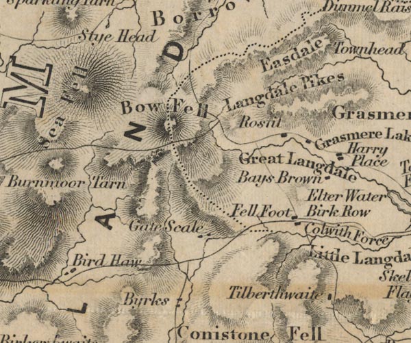 FD02NY20.jpg "Easdale" Between hill hachures. item:- JandMN : 100.1 Image © see bottom of page |
|
|
|
||
| evidence:- | old map:- Garnett 1850s-60s H placename:- Easedale |
|
| source data:- | Map of the English Lakes, in Cumberland, Westmorland and
Lancashire, scale about 3.5 miles to 1 inch, published by John
Garnett, Windermere, Westmorland, 1850s-60s.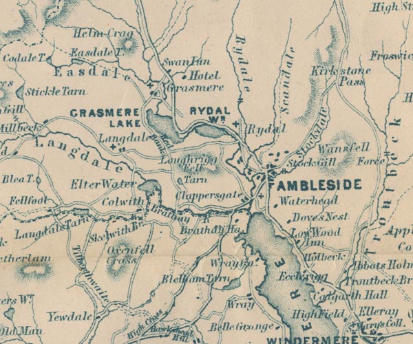 GAR2NY30.jpg "Easedale" river valley item:- JandMN : 82.1 Image © see bottom of page |
|
|
|
||
| evidence:- | old text:- Martineau 1855 |
|
| source data:- | Guide book, A Complete Guide to the English Lakes, by Harriet
Martineau, published by John Garnett, Windermere, Westmorland,
and by Whittaker and Co, London, 1855; published 1855-76. goto source Page 50:- "... He proceeds for a mile between fences before he reaches the opening of Easedale. The gate" goto sourcePage 51:- "and shrubbery to the right are the entrance to Lady Richardson's cottage; and there the regular road ends. The car can go about a mile further along the farm tracks in the valley, through the meadows which yield a coarse hay, and near the stream which is tufted with alders. At the farm house where the car stops, the people will shew the stranger the way he must go,- past the plantation, and up the hill side, where he will find the track that will guide him up to the waterfall,- the foaming cataract, which is seen all over the valley, and is called Sour Milk Ghyll Force. The water and the track together will show him the way to the tarn, which is the source of the stream. Up and on he goes, over rock and through wet moss, with long stretches of dry turf and purple heather; and at last, when he is heated and breathless, the dark cool recess opens in which lies Easedale Tarn. ..." |
|
|
|
||
| evidence:- | old drawing:- Brockbank 1870s placename:- Easedale |
|
| source data:- | Drawing, pencil and ink wash, roche moutonnee, Easedale, Grasmere, Westmorland, July
1871, used by William Brockbank.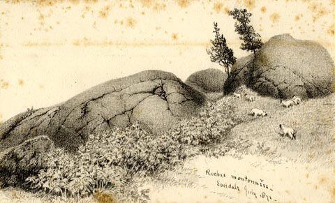 click to enlarge click to enlargePR1930.jpg "Roches moutonnees - / Easedale July 1871 -" "Glaciated Rocks. Easedale / Wm. Brockbank FGS. / 25" item:- Armitt Library : 1959.68.25 Image © see bottom of page |
|
|
|
||
| evidence:- | old drawing:- Brockbank 1870s placename:- Easedale |
|
| source data:- | Drawing, pencil and ink wash, glacial erratic, below Easedale Tarn, Easedale, Grasmere,
Westmorland, September 1872, used by William Brockbank. click to enlarge click to enlargePR1925.jpg "Below Easedale tarn. / Sept 1872" "Easedale / Wm. Brockbank. [F G ] / 20" item:- Armitt Library : 1959.68.20 Image © see bottom of page |
|
|
|
||
| evidence:- | perhaps old print:- Prior 1865 |
|
| source data:- | Print, uncoloured engraving, perhaps Easedale, Westmorland, published by John Garnett,
Windermere, Westmorland, and by Simpkin, Marshall and Co, London, 1865.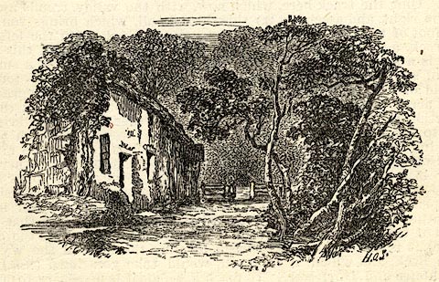 click to enlarge click to enlargePI0102.jpg Included on page 14 of the guide book, Ascents and Passes in the Lake District of England, by Herman Prior. item:- JandMN : 235.4 Image © see bottom of page |
|
|
|
||
| evidence:- | old painting:- placename:- Easedale |
|
| source data:- | Painting, watercolour, Easedale, Westmorland, by Samuel Bough, 1850.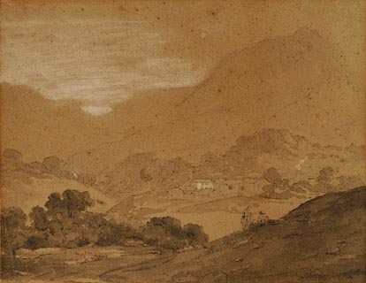 click to enlarge click to enlargePR0981.jpg View across the valley from an elevated perspective; two lightly sketched figures rest on the hillside in foreground. A farmstead stands in middle distance beyond which rise barren fells. inscribed & dated &signed at bottom right:- "Easdale Sep 1850 Sam Bough" item:- Tullie House Museum : 1960.52.2 Image © Tullie House Museum |
|
|
|
||
 BNR36.jpg (taken 22.5.2007) |
||
|
|
||
Lakes Guides menu.