 Ford 1839 map NY10


|

|
|
|
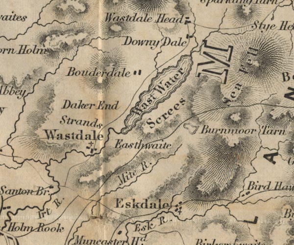
gazetteer links places may or may not be labelled on the map |
||

|
-- Boot -- "Eskdale" |
|
|
|
-- Bowderdale -- "Bouderdale" |
|
|
|
-- Burnmoor Tarn -- "Burnmoor Tarn" |
|
|
|
-- Down in the Dale -- "Downy Dale" |
|
|
|
-- Easthwaite -- "Easthwaite" |
|
|
|
-- Mite, River -- "Mite R." |
|
|
|
-- Nether Wasdale -- "Strands / Wastdale" |
|
|
|
-- Santon Bridge -- "Santon Bridge" |
|
|
|
-- Sca Fell -- "Sea Fell" |
|
|
|
-- Screes, The -- "Screes" |
|
|
|
-- Wasdale Hall -- "Daker End" |
|
|
|
-- Wast Water -- "Wast Water" |
|
|
civil parishes The area roughly includes parts of parishes:- Gosforth Eskdale Ennerdale and Kinniside Nether Wasdale Irton with Santon Muncaster |
||
|
|
||
|
|
Lakes Guides menu. | |