 Crosthwaite 1783-94, tetrad SD39Y

|

|
|
|
gazetteer links places may or may not be labelled on the map |
||

|
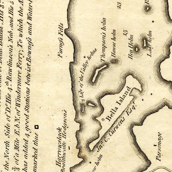
-- Belle Isle -- "Bella Island / Jno. C. Curwen's
Esqr." -- "..., His [Thomas West's] 2d. Station is the
South Side of Bella Island. His 3d. the North Side of do. ...
..." |
|
|
|
-- Furness Fells -- "Furness Fells" |
|
|
|
-- Harrow Slack -- "Harrowslack / Mr. Braithwaite
Hodgson's" |
|
|
|
-- Haws Holme -- "Hawse holm" |
|
|
|
-- Hen Holme -- "Hen holm" |
|
|
|
-- Lady Holme -- "Lady holm" |
|
|
|
-- Lilies of the Valley -- "2 Lily of the Valley
holms" |
|
|
|
-- Rectory, The -- "Parsonage" |
|
|
|
-- Thompson's Holme -- "Thompson's holm" |
|
|
civil parishes The area roughly includes parts of parishes:- Windermere Claife |
||
|
|
||
|
|
Lakes Guides menu. | |