 Clarke 1787 map, tetrad NY42R

|

|
|
|
gazetteer links Places may or may not be labelled on the map. |
||

|
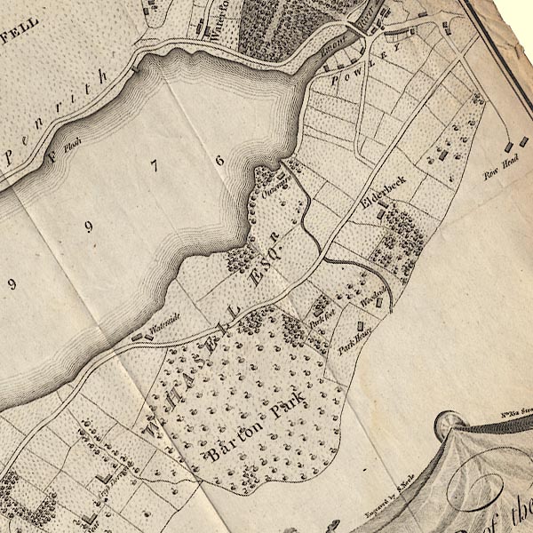
-- Aik Beck |
|
|
|
-- "Barton Park" -- Barton Park |
|
|
|
-- (boat house, Dacre) |
|
|
|
-- "Elderbeck" -- Elderbeck |
|
|
|
-- "Ouzemire" -- Eusemere |
|
|
|
-- "Flosh" -- Flosh |
|
|
|
-- Gale Bay |
|
|
|
-- "Park Foot" -- Park Foot Farm |
|
|
|
-- "Park House" -- Parkhouse |
|
|
|
-- "Powley" -- Pooley Bridge |
|
|
|
-- Patterdale to Penrith |
|
|
|
-- Pooley Bridge to Martindale |
|
|
|
-- "Row Head" -- Roehead |
|
|
|
-- Roehouse |
|
|
|
-- "Waterside" -- Waterside House |
|
|
|
-- "Woodside" -- Woodside |
|
|
civil parishes The area roughly includes parts of parishes:- Barton Dacre Matterdale |
||
|
|
||
|
|
Lakes Guides menu. | |