 Clarke 1787 map, tetrad NY31Z

|

|
|
|
gazetteer links Places may or may not be labelled on the map. |
||

|
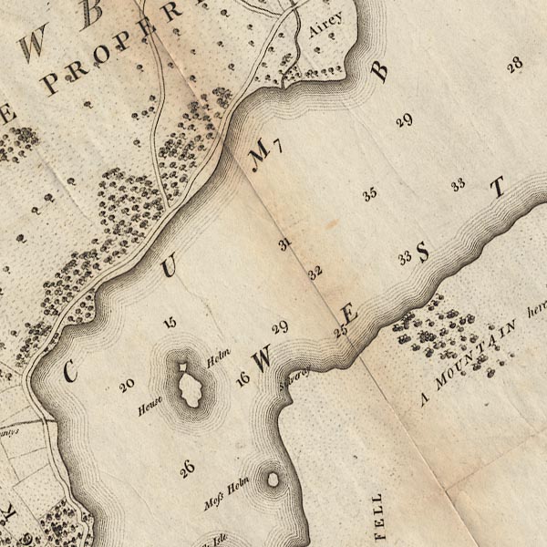
-- "Airey" -- Aira Point |
|
|
|
-- "Moss Holm" -- Lingy Holm |
|
|
|
-- "House Holm" -- Norfolk Island |
|
|
|
-- Patterdale to Penrith |
|
|
|
-- "Silveray" -- Silver Point |
|
|
civil parishes The area roughly includes parts of parishes:- Patterdale Matterdale |
||
|
|
||
|
|
Lakes Guides menu. | |