 Reid and Wallis 1820

|

|
|
|
item:- Armitt Library : ALMC2008.14.51 image:- © see bottom of page |
click to enlarge |
|
|
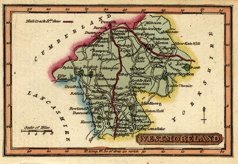
Map, hand coloured engraving, Westmoreland ie
Westmorland, scale about 14.5 miles to 1 inch, printed by
James Wallis, Berwick Street, Soho, published by W H Reid,
Charing Cross, London, about 1820.
Included in The Panorama or Traveller's Instructive Guide throughout England and Wales. Notice that the post route is emphasized. |
||

|
Reid and Wallis 1820 | |
| map feature:- | plain cartouche & north point & up is N & scale line & lat and long scales (rectangular projection, longitude from Greenwich) & coast line & rivers & lakes (??) & parks & county & settlements & roads & post roads | |
| inscription:- |
printed lower right
WESTMORELAND |
|
| inscription:- |
printed above scale line
Scale of Miles |
|
| scale line:- | 8 miles = 13.9 mm | |
| longitude, Kendal:- | 2d 46m W (approx) | |
| wxh, sheet:- | 12x8cm | |
| wxh, map:- | 105x69mm | |
| scale:- | 1 to 930000 ? (1 to 926241 from scale line assuming a statute mile) | |