 Greenwood and Hodgson 21.6.1823

|

|
|
|

|
introduction | ||
|
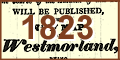
Westmorland Gazette, 21 June 1823:-
|
|||
|
advertisement for C
Greenwood
|
|||
|
WESTMORLAND.
In the course of the Autumn of this Year, WILL BE PUBLISHED THE NEW MAP OF Westmorland, BEING THE THIRTEENTH OF THE SERIES OF NEW MAPS OF THE Counties of England & Wales, FROM ACTUAL SURVEY, BY C. AND J. GREENWOOD. IN former times the Survey of a County was considered a speculation of so serious a nature, that few individuals were found willing to venture upon it: and though Premiums (from one valuable Institution in particular) were offered, as an inducement to the promotion of works of this kind, yet at so late a period as the beginning of the present century, few Maps of any of the Counties of England and Wales could be found to be depended upon. It must nevertheless be admitted, that those which did exist, (with some exceptions) had been made on principles of science, reflecting credit upon their authors; but having been surveyed at so many different periods, and those periods generally remote, it must be admitted that they could bear but little resemblance to the present altered state of the Districts they formerly represented. It is the object, therefore, of the Proprietors of the Series of New Maps of the Counties of England and Wales, to complete one uniform Atlas of these Counties, in a similarity of style, and within a limited period. And calculating upon their claim to public confidence from the many years they have been engaged in the undertaking, and more particularly from the results of their labours in the production of Maps of Twelve of the Counties (amongst which will be found some of the largest in the kingdom,) they trust they can with propriety assert, that within the further period of about Eight Years they will be enabled to accomplish the highest object of their ambition, in the completion of the first uniform Series of Maps of the English and Welch Counties ever made from actual survey. Works of this nature and magnitude can scarcely ever be sufficiently appreciated but by those who are practically engaged in them, and consequently lose much of their importance, by a want of publicity and proper representation: the Proprietors will therefore esteem themselves highly obliged to those who may favour them with a call at either of their Offices, and where they trust such Information will be given, with other indubitable Proofs of their Claim to Public Support, as will yield the utmost satisfaction to every candid enquirer. The Proprietors here beg to observe, that they have, at different periods of the progress of their Work, had to contend with opposition, which has generally arisen out of improper motives, by individuals whose services they have from one cause or another been obliged to dispense with, and which has uniformly ceased to exist when proper descriptions of them have come before the Public. Every caution was taken at the commencement of this concern, not to injure the interest of those who might possess property in copyrights existing, or who might then be engaged in the Survey of any of the Counties; and with a view to this object, such inquiry was made, as was deemed necessary for that purpose, and also [demonstrated that the County Maps generally were in a state so defective as but ill accord withe present literary and scientific character] of the country. Under these considerations the Proprietors of this Work determined upon their present undertaking, and circulated notices of their intentions by public Advertisement; this Work was therefore immediately commenced, and has now been proceeded in with unremitting application during a period of nearly Nine Years; and as it continues to involve a capital, which can only be redeemed by final completion of the whole Series, the Proprietors are bound, whatever sacrifices they are obliged to make, to protect themselves as much as possible against any attempts that may be made to frustrate their ultimate object. Trusting, therefore, to a continuance of that unbounded patronage, which has so peculiarly distinguished this work, and which could only have accumulated by repeated proofs of its undoubted pretensions to merit - the Proprietors will continue to pursue their operations with increased vigour; and they are now considerably augmenting their establishment of Surveyors and Artists, that the engagements made with their numerous Subscribers and the Public may be fully realized. In this Series of Maps is comprehended a genuine delineation of the face of the country. The Residences of the Nobility and Gentry are beautifully represented; Parks, Plantations, Pleasure Grounds, Water, Woods, &c. are ornamentally and clearly described; the Boundaries of the Wapentakes, Hundreds, Wards, &c. and of the Parishes and Townships, are accurately delineated; Roads, Rivers, Canals, Cities, Towns, Villages, Farm-Houses, &c. are faithfully introduced, and every feature calculated to promote the interesting appearance, and to combine the essential qualifications of a usefulness, perspicuity, and elegance, studiously united and harmonized in the scientific construction and general arrangement of the Work. The Engraving is executed in a superior manner, by Artists of the first eminence; and appropriate Embellishments got up and introduced in the most tasteful and masterful style. Price of the whole Series (Proof Impressions) in Sheets, 125 Guineas; and for individual Counties, according to the Scale of Prices given below. No Money is received but for each Map when delivered. Further Particulars may be had on application to Mr. GEORGE PRINGLE, jun. Repository for the Sale of these Maps, 70 Queen Street, Cheapside; and at the Offices of Messrs. GREENWOOD, Surveyors, 174, Piccadilly, London. March 1, 1823. ... A list of maps and prices is given; listed by county, the scale in inches to a mile, the number of sheets, and price in Lsd. MAPS PUBLISHED ... Lancashire ... 1 ... 6 ... 3 3 0 ... Cumberland ... 1 ... 6 ... 3 3 0 ... MAPS TO PUBLISH. ... Westmorland ... 1 ... 4 ... 3 3 0 ... The Proprietors of the Series of New Maps of the Counties of England and Wales, having at former periods occasionally published Lists of the Subscribers to the Work, are unwilling, altogether, to abandon a plan so well calculated to convey to the Public a sense of its importance and magnitude; but the great accumulation of Patronage having rendered it impossible to insert the whole as usual, they have selected from upwards of ten thousand names, now on their Books, those of the following illustrious, noble, and highly respectable Personages. HIS MOST GRACIOUS MAJESTY THE KING. and so on through princes, dukes, marquises, earls, lords, baronets, knights, viscounts, and bishops. This grand advertisement was found repeated in the Westmorland Gazette 28 June 1823 and 5 July 1823, and appears in the Kendal Chronicle 21 June1823, 28 June 1823 and 5 July 1823. |
|||
|
Summary from - C Greenwood |
|||
| ADVERTISEMENT |
for his new Map of Westmorland, and reasons why,
prices
|
||
| SUBSCRIBERS |
list of subscribers, royalty and nobility
|
||
|
|
next item | ||
|
|
|||
Lakes Guides menu.