 Saxton 1576 NY65


|

|
|
|
gazetteer links places may or may not be labelled on the map |
||

|
-- |
|
|
|
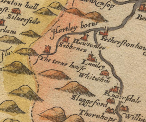
-- Featherstone -- "Fetherstonhaughe" |
|
|
|
-- Halton Lea -- "Hawtonlee" |
|
|
|
-- Hartley Burn -- "Hartley borne" |
|
|
|
-- Knarsdale -- "Knaresdale" |
|
|
|
-- Lambley -- "Lamley" |
|
|
|
-- Sibenese (?) -- "Sibbenes" |
|
|
|
-- Slaggyford -- "Slaggesford" |
|
|
|
-- South Tyne, River -- "S: Tyne flu:" |
|
|
|
-- Tarn House -- "The terne howse" |
|
|
|
-- Whitwham -- "Whitwham" |
|
|
civil parishes The area roughly includes parts of parishes:- Farlam Midgeholme Geltsdale Ainstable |
||
|
|
||
|
|
Lakes Guides menu. | |