 Saxton 1576 NY51


|

|
|
|
gazetteer links places may or may not be labelled on the map |
||

|
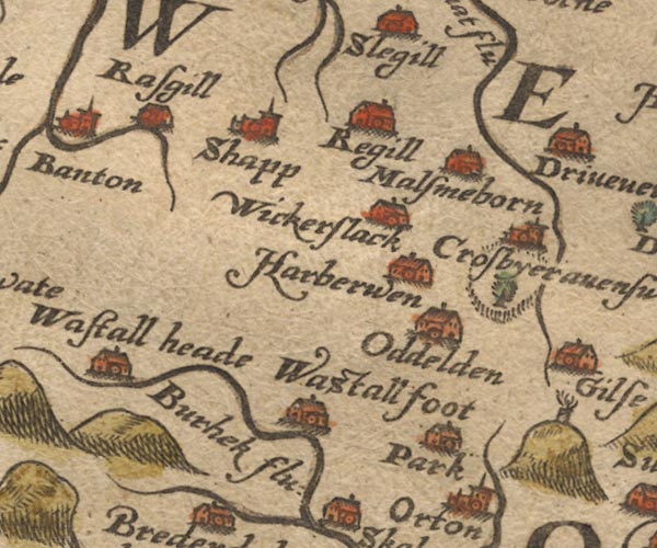
-- Birk Beck -- "Burhek flu:" |
|
|
|
-- Crosby Ravensworth -- "Crosbyeravenswath" |
|
|
|
-- Harberwain -- "Harberwen" |
|
|
|
-- Maulds Meaburn -- "Malsmeborn" |
|
|
|
-- Oddendale -- "Oddelden" |
|
|
|
-- |
|
|
|
-- Park -- "Park" |
|
|
|
-- Reagill -- "Regill" |
|
|
|
-- Rosgill -- "Rasgill" |
|
|
|
-- Shap -- "Shapp" |
|
|
|
-- Wasdale Beck -- "Burhek flu:" |
|
|
|
-- Wasdale Foot (?) -- "Wastall foot" |
|
|
|
-- Wasdale Head -- "Wastall heade" |
|
|
|
-- Wickerslack -- "Wickerslack" |
|
|
civil parishes The area roughly includes parts of parishes:- Newby Shap Little Strickland Sleagill Bampton Shap Rural Longsleddale Crosby Ravensworth Thrimby Lowther |
||
|
|
||
|
|
Lakes Guides menu. | |