 Saxton 1576 NY01


|

|
|
|
gazetteer links places may or may not be labelled on the map |
||

|
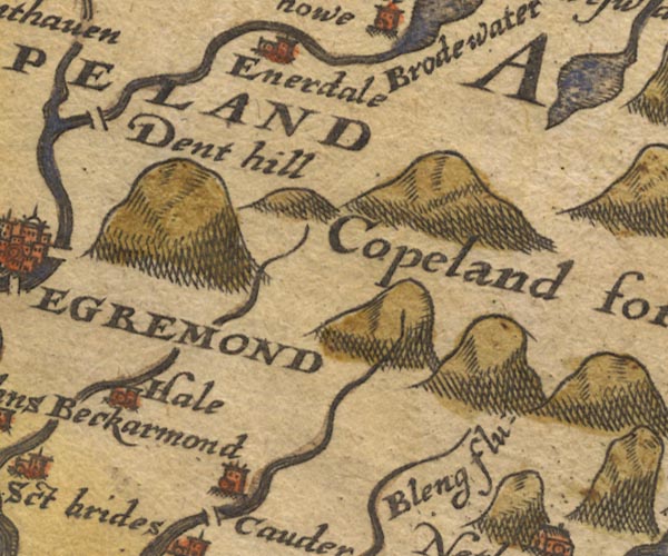
-- Bleng, River -- "Bleng flu:" |
|
|
|
-- Copeland Forest -- "Copeland forest" |
|
|
|
-- Copeland -- "COPELAND" |
|
|
|
-- Ennerdale Bridge -- "Enerdale" |
|
|
|
-- Haile -- "Hale" |
|
|
|
-- Long Barrow -- "Dent hill" |
|
|
|
-- Mosedale Beck |
|
|
civil parishes The area roughly includes parts of parishes:- Haile St John Beckermet Ennerdale and Kinniside Cleator Moor Arlecdon and Frizington St Bees Egremont Whitehaven Weddicar Moresby St Bridget Beckermet Lowside Quarter Lamplugh |
||
|
|
||
|
|
Lakes Guides menu. | |