 Thomas 1916

|

|
|

|
back to object record | |
| Thomas 1916 | ||
|
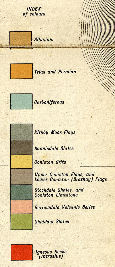
H N Thomas drew a Geological Map of the Lake District, scale
about 4 miles to 1 inch, derived from the Ordnance Survey
and Geological Surveys, from the Geology of the Lake
District by J E Marr, published by Cambridge University
Press, 1916. The:-
|
||
|
INDEX of colours
|
||
|
has:-
|
||
|
||
|
Alluvium Trias and Permian Carboniferous Kirkby Moor Flags Bannisdale Slates Coniston Grits Upper Coniston Flags, and Lower Coniston (Brathay) Flags Stockdale Shales, and Carboniferous Limestone Skiddaw Slates Igneous Rocks (intrusive) |
||
Lakes Guides menu.