 Smith 1824

|

|
|

|
back to object record | |
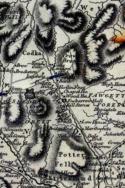
| Smith 1824, Longsleddale | ||
|
Notes about Longsleddale from the Geological Map of
Westmoreland, scale about 2.5 miles to 1 inch, by William
Smith, coloured on a map by John Cary, published by John
Cary, 86 St James's Street, London, 1824.
|
||
|
||
|
|
||
| scale |
The map scale is about:-
1 to 160000 ? (1 to 156437 from scale line, assuming a statute mile) 2.5 miles to 1 inch |
|
|
Places are identified on the uncoloured map issued later by
John Cary, see:-
|
||
|
|
||
| Geology | ||
|
The map was provided by John Cary for William Smith to
colour geologically. The northern area is now known as
Borrowdale Volcanic series, the southern as Brathay Flags,
and the band between the Coniston Limestone Series (all
probably outofdate terminolgy).
|
||
Lakes Guides menu.