 Reynolds 1848

|

|
|

|
back to object record | |
| Map Features | ||
|
|
||
| title |
Printed upper left and right of the north sheet:-
ISLE OF MAN / NORTH CUMBERLAND Printed lower left of the south sheet:- 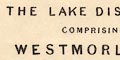
THE LAKE DISTRICT COMPRISING WESTMORLAND AND PARTS OF CUMBERLAND & LANCASHIRE |
|
|
|
||
|
orientation
north point up is N |
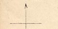
Printed on each sheet is a north point; N-S line, E-W cross line, North marked by an arrow. The maps are printed with North at the top. |
|
|
|
||
|
scale line
scale |
Printed lower left of the south sheet is a scale of
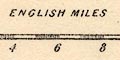
ENGLISH MILES chequered in miles, labelled at two mile intervals. The 12 miles = 38.0 mm gives a scale 1 to 508214. The map scale is about:- 1 to 510000 8 miles to 1 inch |
|
|
|
||
| table of symbols |
Printed lower left of the south sheet is an explanation
just for:-
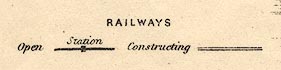
RAILWAYS Open [bold line, square block] Station Constructing [double line] |
|
|
|
||
|
sea area
sea plain |
The sea area is plain. Some sea areas are labelled,
eg:-
SOLWAY FIRTH Morecambe Bay |
|
|
|
||
|
coast line
coast shaded headlands |
The coast line is emphasized by shading. One headland is labelled:- St. Bees Hd. Harbours are not noticed. |
|
|
|
||
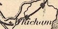
| rivers |
Rivers are drawn by a wiggly line tapering upstream. The broad part near its estuary might be a double line with a hint of stream lines. Some rivers are labelled, eg:- Duddon R. River Tees R. Eden |
|
|
|
||
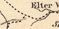
| lakes |
Lakes are drawn in outline, shaded. Islands might be drawn, as in Windermere, Ullswater, and Derwent Water. Some lakes are labelled:- Bassenthwaite Wr. Burnmoor Tarn Buttermere Wr. Coniston Water Crummock Wr. Derwent Wr. Devock Wr. Easthwaite W. Elter Wr. Ennerdale Wr. Grasmere L. Hawes Wr. Kentmere Tarn Lowes Wr. Reserv. [Killington] Thirl Mere Tindale Tarn Ulles Water Wast Wr. Winder Mere Other lakes and tarns might recognized, eg:- Floutern Tarn Watendlath Tarn Blea Tarn [Borrowdale] Great Rundale Tarn Little Rundale Tarn [or Seamore Tarn] Skeggles Water Blea Water Small Water Scales Tarn Easedale Tarn Blindtarn Moss [perhaps] Rydal Water Brothers Water Hayes Water Cardurnock Lough Levers Water Seathwaite Tarn Red Tarn [Helvellyn] Grisedale Tarn Talkin Tarn Scoat Tarn [or Low Tarn?] Styhead Tarn [or Sprinkling Tarn, draining to Wastwater] |
|
|
|
||
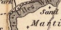
| forests |
Woodland is not indicated.
Some forests are labelled, eg: 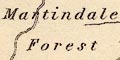
Martindale Forest Copeland Forest Spadeadam Waste |
|
|
|
||
| parks |
A few parks are drawn in outline. These are not always
labelled, but see:-
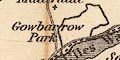
Gowbarrow Park Others might be recognized by a nearby place, as at Holker. |
|
|
|
||
| county |
County boundaries are a dashed line which is carried on alongside a boundary feature. The three counties of the map title are not labelled, the user must know where each is, but adjacent counties are labelled, eg:- NORTHUMBERLAND |
|
|
|
||
|
settlements
street plan distances from London |
Settlements are marked by groups of blocks or a cross,
further differentiated by style of labelling.
|
|
| cities |
group of blocks on a minimalist street plan; labelled in
upright block caps:-
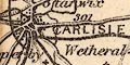
CARLISLE / 301 with the distance from London. Notice Lancaster, not strictly a city, is labelled in italic block caps. The block caps might indicate county town rather than city. |
|
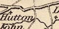
| towns |
group of blocks, perhaps round a road intersection;
labelled in upright lowercase text, eg:-
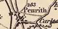
Penrith / 283 Kirkoswald / 292 Orton / 376 Appleby / 270 Kendal, the de facto county town, is labelled in upright block caps. |
|
|
villages
hamlets |
a cross; labelled in italic lowercase text, eg:-
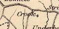
Crook Kentmere Gt. Salkeld Ivegill |
|
|
|
||
| roads |
A network of roads is drawn by double lines. More important roads have light bold lines. |
|
|
|
||
| canals |
Canals are drawn by a curvy bold line. The Lancaster Canal and Port Carlisle canal are shown. |
|
|
|
||
| railways |
As explained in the table of symbols, existing railways
are drawn by a bold line, stations marked by a square block
on the line.
Railways under construction are a double line. 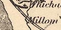
The following railways are shown:- |
|
| Newcastle and Carlisle Railway |
opened 1836
via Haltwhistle, Northumberland; near Brampton, to Carlisle, Cumberland. |
|
| Maryport and Carlisle Railway |
opened 1840-45
from Maryport, through Aspatria, Wigton, to Carlisle. |
|
| Lancaster and Carlisle Railway |
opened 1846
from Lancaster, through Carnforth, Lancashire; then Milnthorpe, Oxenholme, Tebay, Shap, Westmorland; then Penrith, to Carlisle, Cumberland. |
|
| Kendal and Windermere Railway |
opened 1846-47
from Oxenholme, through Kendal, to Windermere, Westmorland. |
|
| Whitehaven Junction Railway |
opened 1846-47
from Maryport, through Workington, to Whitehaven, Cumberland. |
|
| Furness Railway |
opened 1846-54
from Dalton to Barrow-in-Furness, Lancashire; AND from Kirkby to Barrow-in-Furness, Lancashire; AND extension from Kirkby in Furness to Broughton in Furness, Lancashire; ETC. A route directly across the Duddon Estuary from Millom to Dalton is shown under construction, and also a route into Barrow from the east. |
|
| Cockermouth and Workington Railway |
opened 1847
from Cockermouth, to Workington, Cumberland. |
|
| Caledonian Railway |
opened 1849-50
from the north through Gretna, Scotland; to Carlisle, Cumberland. |
|
| Whitehaven and Furness Junction Railway |
opened 1849-55
from Whitehaven, through St Bees, Ravenglass, Millom, Cumberland; to Foxfield, Lancashire. |
|
| Alston branch railway |
opened 1852
Shown as under construction. from Haltwhistle, Northumberland; to beyond Alston, Cumberland. |
|
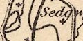
| Low Gill and Ingleton branch railway |
opened 1861
Shown as under construction. from Low Gill, Westmorland; through Sedbergh, Yorkshire; then Kirkby Lonsdale, Westmorland; southward across Lancashire; into Yorkshire. |
|
| Eden Valley Railway |
opened 1862
Shown as under construction. from Kirkby Stephen, to Clifton, Cumberland. |
|
| Cockermouth, Keswick and Penrith Railway |
opened 1864-65
Shown as under construction from Cockermouth to Keswick round the north of Bassenthwaite Lake. |
|
|
These railways suggest a date of the map edition about 1860s, with some lines missing, such as the Glasgow, Dumfries and Carlisle Railway, the Whitehaven, Cleator and Egremont Railway, Ulverstone and Lancaster Railway, etc. |
||
|
|
||
| miscellaneous | ||
|
|
||
|
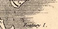
antiquities
roman wall |
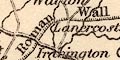
Hadrian's Wall is drawn by a line with fence palings from between Drumburgh and Burgh by Sands, through Carlisle, then north east and east into Northumberland. Labelled:- Roman Wall |
|
Lakes Guides menu.