 Speed 1611

|

|
|
|
item:- Armitt Library : 1959.187 image:- © see bottom of page |
click to enlarge |
|
|
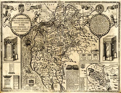
Map, uncoloured engraving, Cumberland, scale about 4
miles to 1 inch, by John Speed, published by Thomas Bassett,
The George, Fleet Street, and Richard Chiswell, The Rose and
Crown, St Paul's Churchyard, London, 1611 or later.
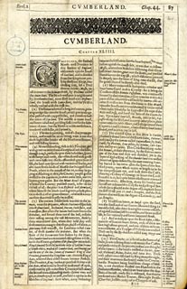
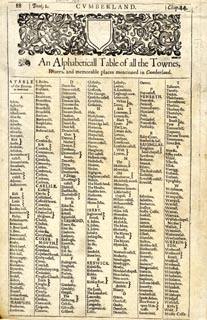
There is an inset map of Carlile. The reverse of the map is pp.87 and 88; text in English. Included in The Theatre of the Empire of Great Britain by John Speed. |
||

|
Speed 1611 | |
| map feature:- | picture frame border & picture frame cartouche & coat of arms & heraldic border & descriptive text & vignettes & labelled borders & scale line & sea moire effect & coast shaded & rivers & bridges & lakes & relief & hillocks & woods & forests & parks & county & settlements & inset map | |
| inscription:- |
printed title cartouche, upper left
CUMBERLAND / AND THE ANCIENT CITIE / CARLILE DESCRIBED / WITH / MANY MEMORABLE AN / TIQUITIES THEREIN / FOUND OBSERVED |
|
| inscription:- |
printed reverse, p.87
CUMBERLAND. / CHAPTER XLIIII. / CUmberland, the furthest North-west Province in this Realme of England, co~fronteth upo~ the South of Scotland, and is divided from that Kingdome partly by the River Kirsop, then crossing Eske, by a Tract thorow Solome-Mosse, until it come to the Solwaye Frith, by Ptolemie called Itune Baye. The North-west part is neighboured by Northumberland, more East-ward with Westmerland, the South with Lanca-shire, and the West is wholly washed with the Irish Sea. ... |
|
| inscription:- |
printed lower right of centre
Performed by John Speed, and are to be / sould in Popes. head Alley, by the exchan : / ge by J. Sudbury and Georg. Humble. / Cum Privilegio Anno Domini 1610. |
|
| inscription:- |
printed with scale line
THE SCALE OF MILES |
|
| scale line:- | 10 miles = 64.2 mm | |
| wxh, sheet:- | 51.5x39.5cm | |
| wxh, map:- | 507x384mm | |
| scale:- | 1 to 250000 ? (1 to 249511 from scale line, wrongly assuming a statute mile) | |
|
||
|
||